Now Reading: Five things to know about powerful new U.S.–India satellite, NISAR
1
-
01
Five things to know about powerful new U.S.–India satellite, NISAR
Five things to know about powerful new U.S.–India satellite, NISAR
A new U.S.–India satellite called NISAR (NASA-ISRO Synthetic Aperture Radar) will provide high-resolution data enabling scientists to comprehensively monitor the planet’s land and ice surfaces like never before, building a detailed record of how they shift over time.
Stay Informed With the Latest & Most Important News
[mc4wp_form id=314]
Previous Post
Next Post
Loading Next Post...
Popular Now
-
 01Two Black Holes Observed Circling Each Other for the First Time
 -
 02From Polymerization-Enabled Folding and Assembly to Chemical Evolution: Key Processes for Emergence of Functional Polymers in the Origin of Life
 -
 03Φsat-2 begins science phase for AI Earth images
 -
 04Thermodynamic Constraints On The Citric Acid Cycle And Related Reactions In Ocean World Interiors
 -
 05Hurricane forecasters are losing 3 key satellites ahead of peak storm season − a meteorologist explains why it matters
 -
 06Binary star systems are complex astronomical objects − a new AI approach could pin down their properties quickly
 -
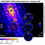
 07Worlds Next Door: A Candidate Giant Planet Imaged in the Habitable Zone of α Cen A. I. Observations, Orbital and Physical Properties, and Exozodi Upper Limits
Scroll to Top


