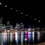
A Sun halo —one of countless ways sunlight interacts with our planet Credit Si Gao When our planet and the incoming sunlight align just right, stunning phenomena such as rainbows

A Sun halo —one of countless ways sunlight interacts with our planet Credit Si Gao When our planet and the incoming sunlight align just right, stunning phenomena such as rainbows
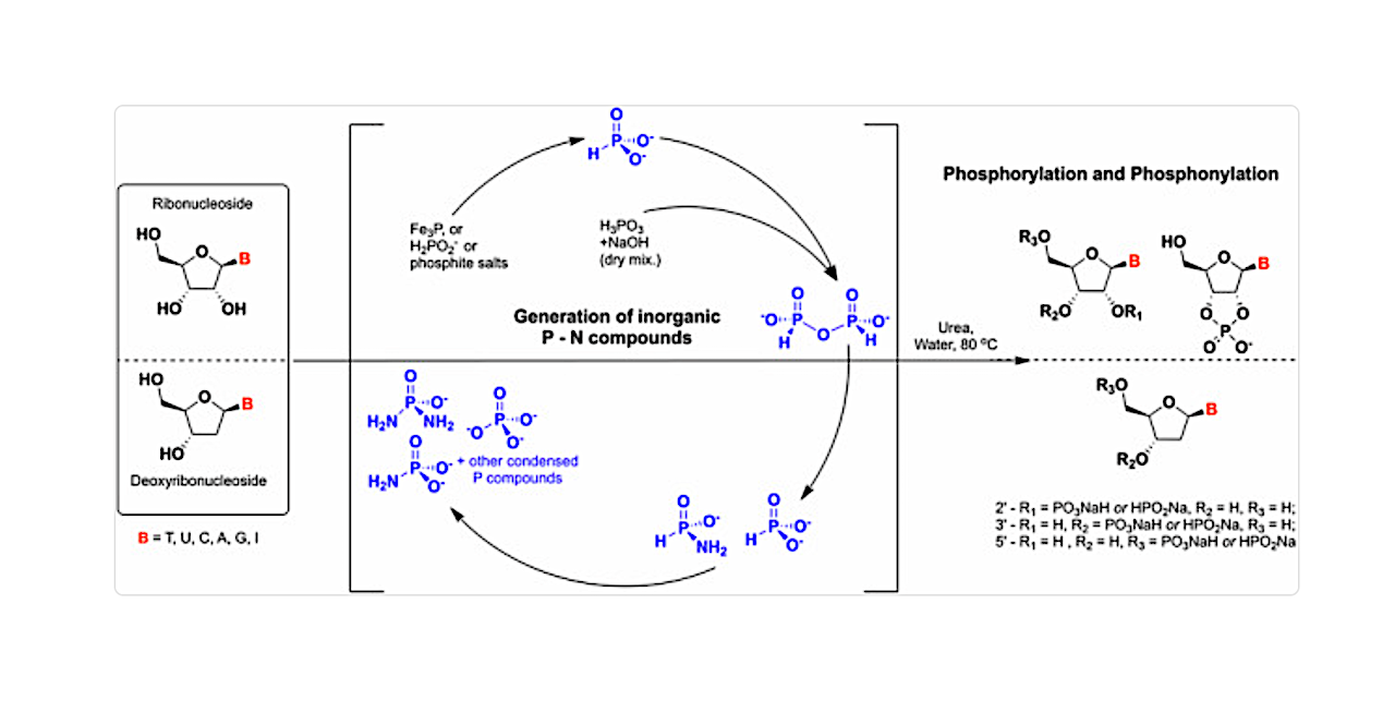
Graphical abstract – Commun Chem. via PubMed P-N species e.g., amidophosphates readily phosphorylate organics, thereby overcoming the so-called ‘Phosphate Problem’. However, the formation of amidophosphates by plausible early Earth geochemical
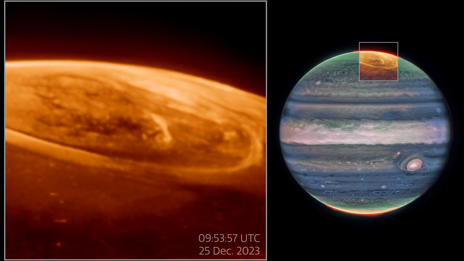
The James Webb Space Telescope has observed glowing auroras on Jupiter like never before. Scientists pointed the James Webb Space Telescope (JWST) at Jupiter on Dec. 25, 2023 and captured
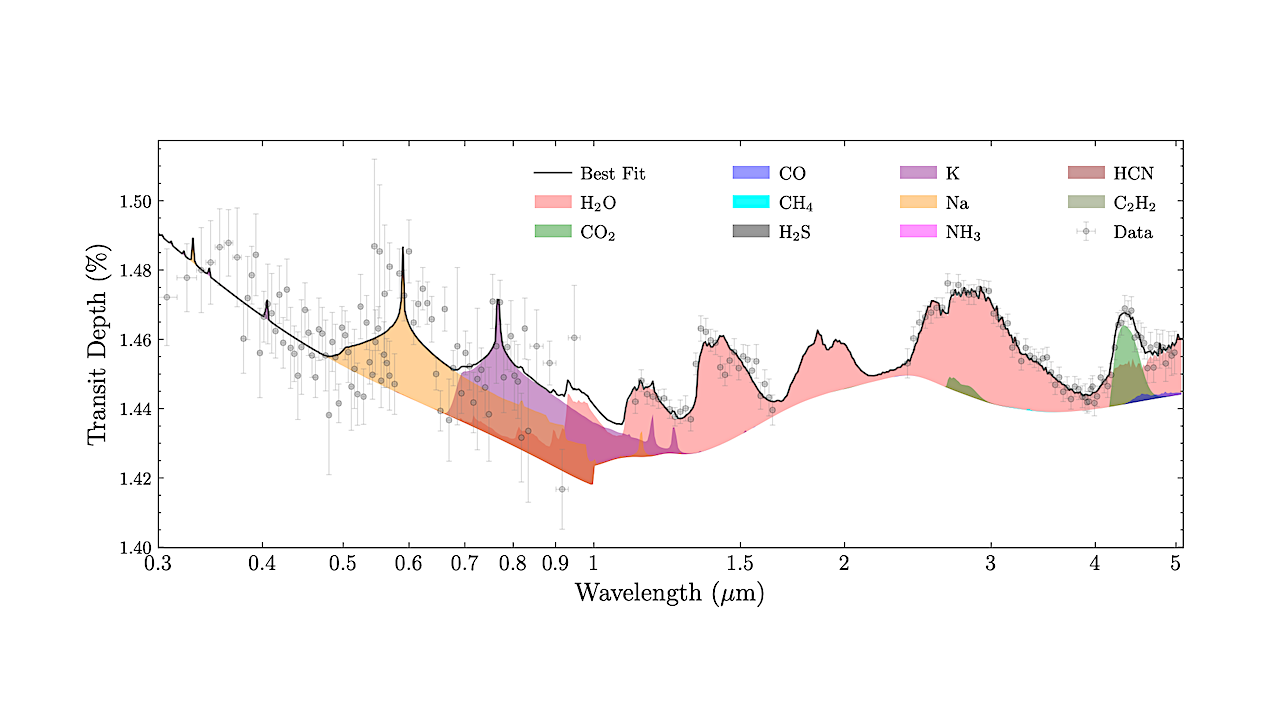
Figure showing the contribution of different gases to the best-fit spectrum obtained from the free chemistry retrieval binned down to R∼200, for STIS+WFC3+NIRCam observations. — astro-ph.EP HD 209458 b is
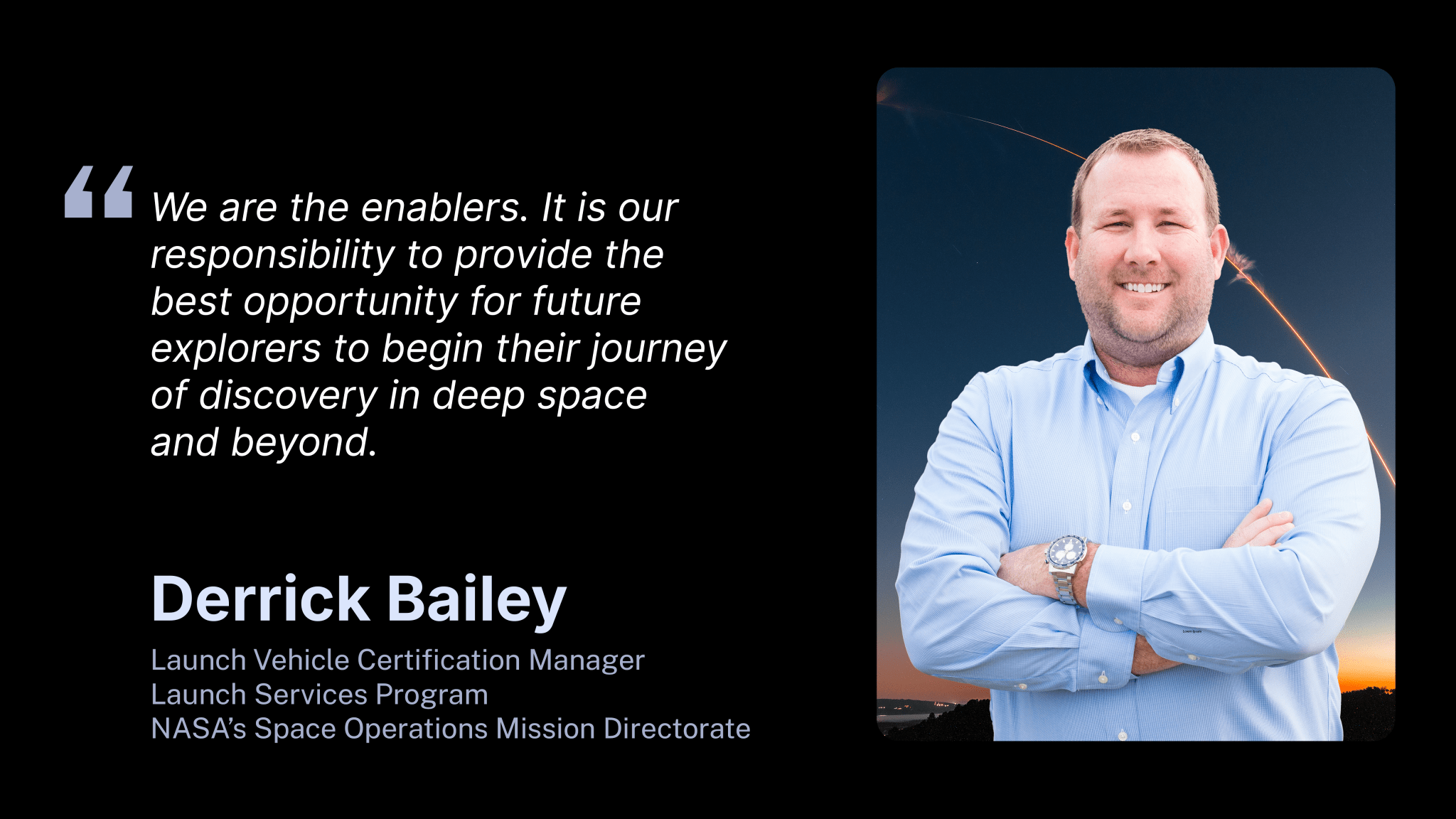
3 min read Preparations for Next Moonwalk Simulations Underway (and Underwater) Since childhood, Derrick Bailey always had an early fascination with aeronautics. Military fighter jet pilots were his childhood heroes,
5 min read Preparations for Next Moonwalk Simulations Underway (and Underwater) Chaitén Volcano in southern Chile erupted on May 2, 2008 for the first time inn 9,000 years. NASA satellites

Although their tones and timbres vary, sirens and alarms are universal harbingers of emergency. Mounted in homes and offices; on police cars, ambulances, and fire engines; and in airports, schools,
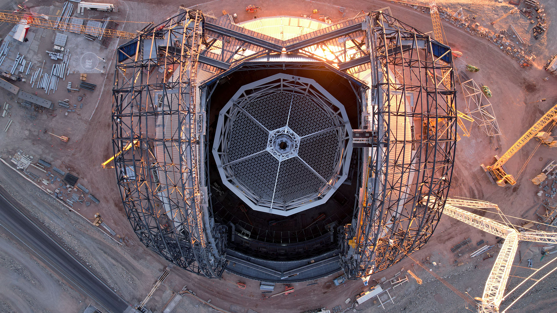
ESO’s Extremely Large Telescope at Cerro Armazones in Chile’s Atacama Desert is seen from directly above while its construction continues. (Image credit: ESO/G / Vecchia) The European Southern Observatory (ESO)’s
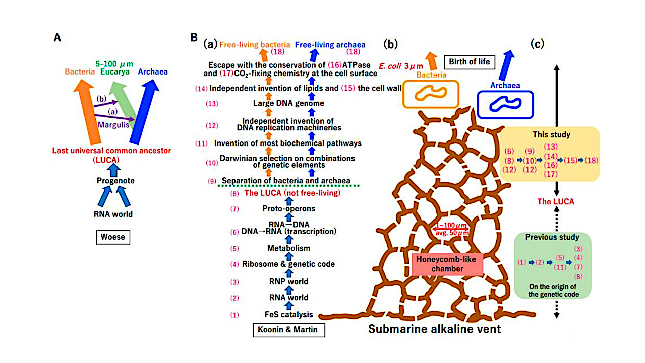
Crystallization of bacteria and archaea. (A) Woese’s model. Phylogenetic analysis of rDNA revealed three domains of life, Bacteria, Archaea, and Eucarya. (a) Symbiosis between Archaea and α-Proteobacteria could yield Eucarya
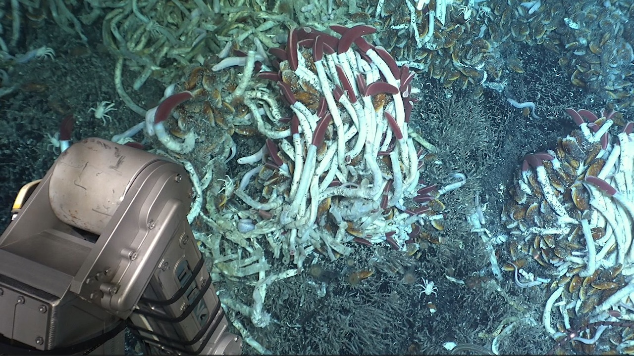
Photo courtesy of Andrew Wozniak, University of Delaware; HOV Alvin Team; Funder: NSF. © Woods Hole Oceanographic Institution Scientists diving in the human-occupied vehicle Alvin recently witnessed a rare but