
Now Reading: Φsat-2 begins science phase for AI Earth images
-
01
Φsat-2 begins science phase for AI Earth images


15/07/2025
535 views
13 likes
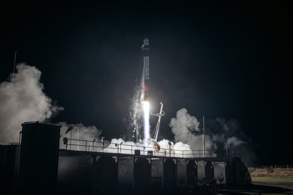
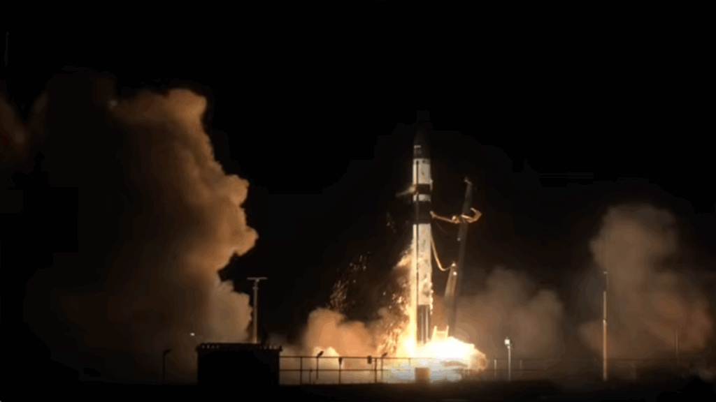
Φsat-2, a miniature satellite, has completed its commissioning and has begun delivery of science data, using algorithms to efficiently process and compress Earth observation images, as well as detect wildfires, ships, marine pollution and more.
The cubesat measuring 22 x 10 x 33 cm was launched in August 2024 and the first image was delivered four days after launch. Since then, the Φsat-2 team has spent nine months commissioning the satellite’s multispectral imager and its onboard AI applications, which carry out a range of activities.
These AI capabilities include selecting images with clear visibility, while discarding images obscured by cloud cover. The algorithms can also detect and analyse disaster areas, for example zones affected by wildfires, earthquakes or floods, and identify access routes for emergency response teams. It can also be used to detect ships, gather data on illegal fishing and marine pollution. Commissioning was concluded in the second quarter of this year and the satellite is now delivering scientific data.
The satellite orbits at an altitude of 510 km. It generates images using seven multispectral bands, from visible to near-infrared, as well as one panchromatic band, with a ground sampling distance of about 5 m. This type of remote-sensing instrument is particularly useful for environmental monitoring, land management and mapping.
To mark the transition from commissioning to science phase, five images have been selected to show a range of capabilities for various end-uses over diverse types of terrain. All images are true colour using red, green and blue spectral bands, except for the image of the Bahia Blanca Estuary, which is false colour using near-infrared spectral band.
- Clavering Øer glaciers, Greenland
- Bahia Blanca Estuary, Argentina
- City of Innsbruck, Austria
- Sediment in Gulf of Tunis, Tunisia
- Ships in Port Said, Egypt
Φsat-2 was designed with the purpose of demonstrating and testing the use of onboard AI in Earth observation. According to Nicola Melega, ESA Earth observation system engineer and responsible for commissioning Φsat-2, the initial plan was to process data onboard and then transmit information generated by the AI applications back to Earth. Nicola said, “As often happens, we realised during the commissioning phase, that there were ways of making the mission more interesting for AI developers and instead of making available only the end results of the onboard processing chain (Level 2 data) we now provide users with an entire collection of Level 1 data products that will help the application development and the training process.”
The ground segment is provided by Open Cosmos and CGI Italy; while Kongsberg Satellite Services (KSAT) provides a ground station service, mainly from antennas in Svalbard. Data are made available on the Insula website by CGI Italy – and are freely available to anyone who wants to register (requests for registration should be sent to insula-info.it@cgi.com).
Φsat-2 is still a demonstrator mission: it is designed to find the limitations and gaps in new technology. Nicola explained, “But its purpose is also to build our understanding of the processes. We can check the performance of the applications and we can also see what resources are needed to manage the mission and process the data.”


Related Posts

Stay Informed With the Latest & Most Important News
Previous Post
Next Post


Advertisement
-
 01Two Black Holes Observed Circling Each Other for the First Time
 -
 02From Polymerization-Enabled Folding and Assembly to Chemical Evolution: Key Processes for Emergence of Functional Polymers in the Origin of Life
 -
 03Astronomy 101: From the Sun and Moon to Wormholes and Warp Drive, Key Theories, Discoveries, and Facts about the Universe (The Adams 101 Series)
 -
 04True Anomaly hires former York Space executive as chief operating officer
 -
 05Φsat-2 begins science phase for AI Earth images
 -
 06Hurricane forecasters are losing 3 key satellites ahead of peak storm season − a meteorologist explains why it matters
 -
 07Binary star systems are complex astronomical objects − a new AI approach could pin down their properties quickly