
Now Reading: Curiosity Blog, Sols 4629-4630: Feeling Hollow
-
01
Curiosity Blog, Sols 4629-4630: Feeling Hollow


2 min read
Curiosity Blog, Sols 4629-4630: Feeling Hollow
Written by Elena Amador-French, Science Operations Coordinator at NASA’s Jet Propulsion Laboratory
Earth planning date: Wednesday, Aug. 13, 2025
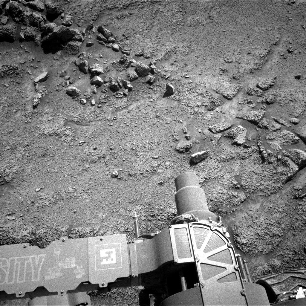
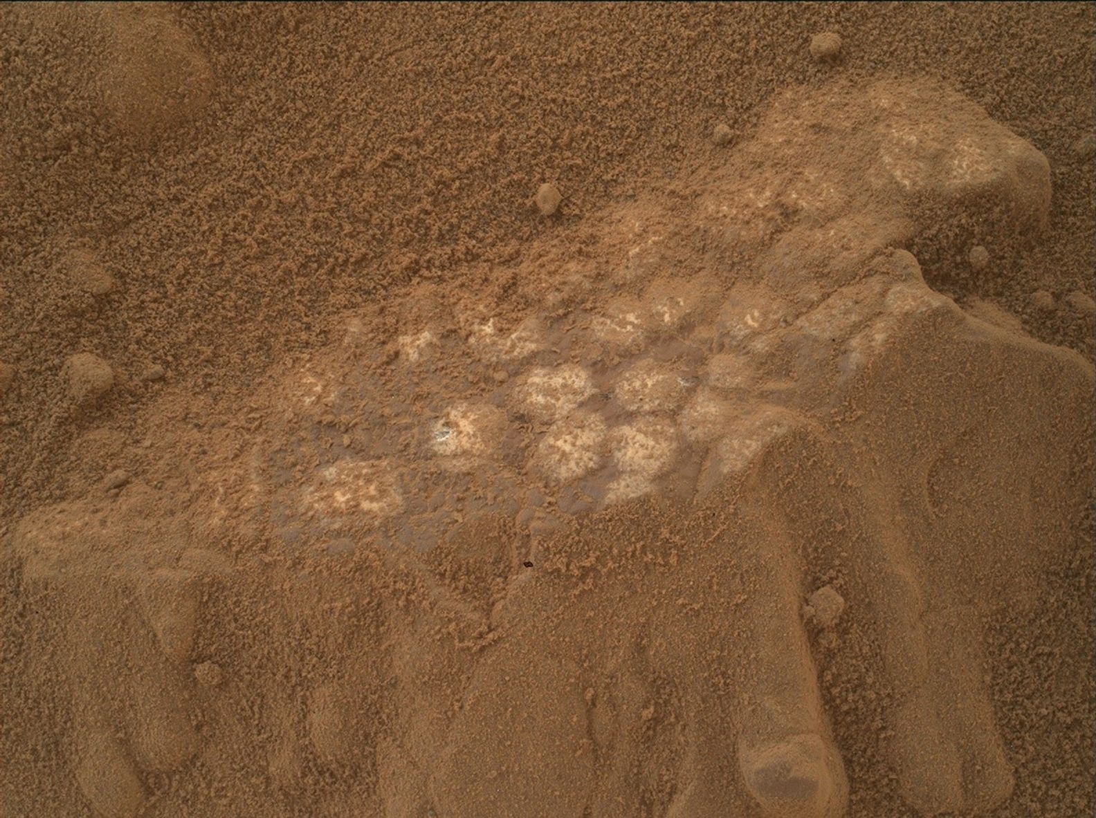
Today’s team investigated the texture and chemistry of the bedrock within a topographic low, or hollow, found within the greater boxwork area. We will place our APXS instrument on the “Asiruqucha” target, some light-toned, small-scale nodular bedrock in the middle of our workspace. These data will help illuminate any systematic chemical trends between the hollows and ridges in this area. We always take an associated MAHLI image with every APXS measurement to help contextualize the chemistry. We will also observe a small crescent-shaped rock named “Wedge Tailed Hillstar” with MAHLI, visible in the above Navcam image just above the letters “SI” written on Curiosity’s arm.
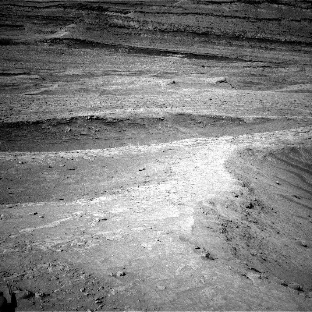
We will use our remote sensing instruments to continue documenting the region taking stereo Mastcam images of “Cerro Paranal,” “Rio Frio,” and “Anchoveta.” The ChemCam instrument will take an image of, and collect chemical information for, the target “Camanchaca,” as well as use its Remote Micro Imager (RMI) to take high-resolution imaging of more distant boxwork features.
Once these observations are completed Curiosity will set off on a 30-meter drive (about 98 feet), taking us to an interesting ridge feature to investigate in Friday’s plan.
As usual we will continue to take our regular atmospheric monitoring observations using REMS, RAD, and DAN.

Share
Details
Related Terms
Explore More


Related Posts


Stay Informed With the Latest & Most Important News
Previous Post
Next Post


Advertisement
-
 01Two Black Holes Observed Circling Each Other for the First Time
 -
 02From Polymerization-Enabled Folding and Assembly to Chemical Evolution: Key Processes for Emergence of Functional Polymers in the Origin of Life
 -
 03Astronomy 101: From the Sun and Moon to Wormholes and Warp Drive, Key Theories, Discoveries, and Facts about the Universe (The Adams 101 Series)
 -
 04True Anomaly hires former York Space executive as chief operating officer
 -
 05Φsat-2 begins science phase for AI Earth images
 -
 06Hurricane forecasters are losing 3 key satellites ahead of peak storm season − a meteorologist explains why it matters
 -
 07Binary star systems are complex astronomical objects − a new AI approach could pin down their properties quickly