
Now Reading: 85 new subglacial lakes detected below Antarctica
-
01
85 new subglacial lakes detected below Antarctica


19/09/2025
251 views
9 likes
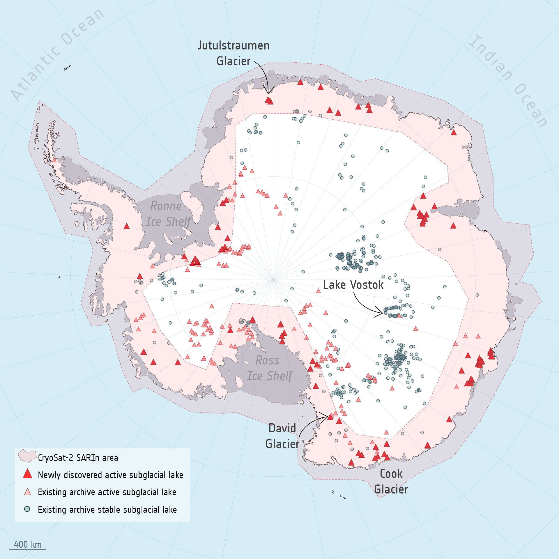
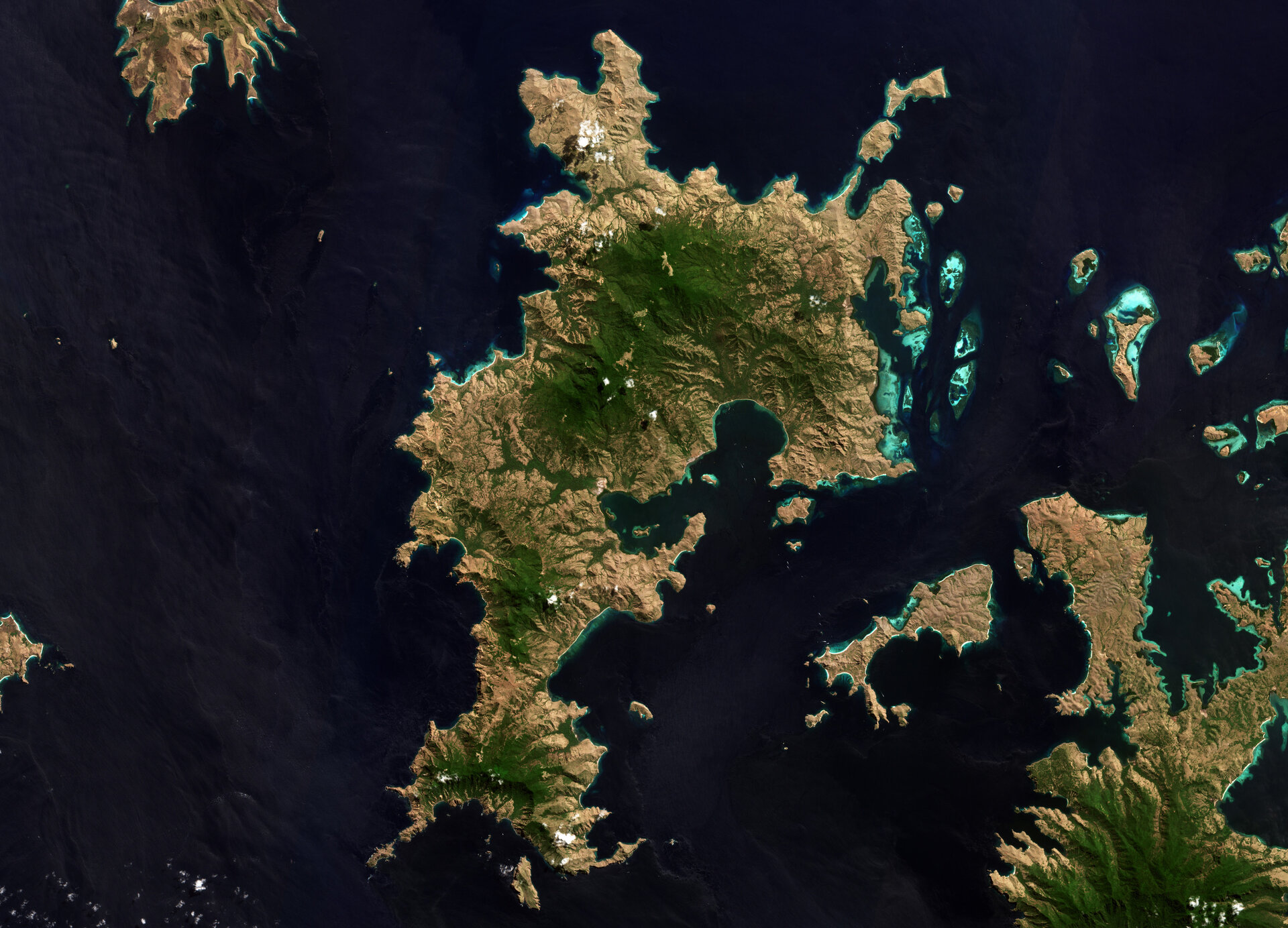
Hidden beneath the biggest ice mass on Earth, hundreds of subglacial lakes form a crucial part of Antarctica’s icy structure, affecting the movement and stability of glaciers, and consequentially influencing global sea level rise.
Thanks to a decade of data from the European Space Agency’s CryoSat satellite, researchers have identified 85 previously unknown lakes several kilometres under the frozen surface surrounding the South Pole. This increases the number of known active subglacial lakes below Antarctica by more than half to 231.
The research, published today in Nature Communications, is significant because active subglacial lakes, which drain and refill on a cyclical basis, offer a rare insight into what is happening far below the surface, at the base of the ice sheet. The research also identified new drainage pathways underneath the ice sheet, including five interconnected subglacial lake networks.
Lead author of the study, Sally Wilson, a doctoral researcher at the University of Leeds, explained that what we know about subglacial lakes and water flow is limited because they are buried under hundreds of metres of ice.
“It is incredibly difficult to observe subglacial lake filling and draining events in these conditions, especially since they take several months or years to fill and drain. Only 36 complete cycles, from the start of subglacial filling through to the end of draining, had been observed worldwide before our study. We observed 12 more complete fill-drain events, bringing the total to 48.”
Why satellites matter
This is where satellites were able to contribute valuable data to the research. Observations from the CryoSat mission, which was launched in 2010, were able to produce a dataset spanning from 2010 to 2020.
ESA’s CryoSat satellite, part of ESA’s FutureEO programme, measures the thickness of polar sea ice and monitors changes in the height of ice sheets over Greenland and Antarctica and glaciers worldwide. Its main instrument is a radar altimeter, which can detect tiny variations in the height of the ice surface as well as measure sea surface height.
Using a decade of observations from CryoSat, researchers detected localised changes in the height of Antarctica’s icy surface, which rises and falls as the lakes fill and drain at the base of the ice sheet. They could then detect and map subglacial lakes and monitor their filling and draining cycles over time.
Anna Hogg, a co-author on the study and Professor at the University of Leeds, said, “It was fascinating to discover that the subglacial lake areas can change during different filling or draining cycles. This shows that Antarctic subglacial hydrology is much more dynamic than previously thought, so we must continue to monitor these lakes as they evolve in the future.”
Sally explained that observations like these are vital to understanding the structural dynamics of ice sheets and how they affect the ocean around them. “The numerical models we currently use to project the contribution of entire ice sheets to sea level rise do not include subglacial hydrology. These new datasets of subglacial lake locations, extents, and timeseries of change, will be used to develop our understanding of the processes driving water flow beneath Antarctica.”
Martin Wearing, ESA Polar Science Cluster Coordinator, noted, “This research again demonstrates the importance of data from the CryoSat mission to improve our understanding of polar regions and particularly the dynamics of ice sheets. The more we understand about the complex processes affecting the Antarctic Ice Sheet, including the flow of meltwater at the base of the ice sheet, the more accurately we will be able to project the extent of future sea level rise.”
How does a subglacial lake form?
Subglacial meltwater forms due to geothermal heat from Earth’s bedrock surface and frictional heat as ice slides over bedrock. This meltwater can pool on the bedrock surface, and periodically drains. This flow of water has the potential to reduce the friction between the ice and the bedrock it sits on, allowing ice to slide more quickly into the ocean.
Not all subglacial lakes are considered active – many are thought to be stable because they are not known to fill or drain. The biggest known subglacial lake is Lake Vostok underneath the East Antarctic Ice Sheet, holding an estimated 5000–65 000 cubic km of water beneath 4 km of ice (the water contained in Lake Vostok is enough to fill the Grand Canyon and overflow by at least 25 %). Although Lake Vostok is thought to be stable, if it did drain, it would impact on the stability of the Antarctic Ice Sheet, surrounding ocean circulation and marine habitats, and global sea level.
Implications for climate modelling
The filling-and-draining cycles of subglacial lakes are an important dataset for icesheet and climate models. By monitoring such phenomena, scientists can improve their understanding of interactions between the ice sheet, bedrock, ocean and atmosphere, which is key to understanding the future stability of ice sheets.
“Subglacial hydrology is a missing piece in many ice sheet models,” said Sally. “By mapping where and when these lakes are active, we can start to quantify their impact on ice dynamics and improve projections of future sea level rise.”


Related Posts
Stay Informed With the Latest & Most Important News
Previous Post
Next Post


Advertisement
-
 01Two Black Holes Observed Circling Each Other for the First Time
 -
 02From Polymerization-Enabled Folding and Assembly to Chemical Evolution: Key Processes for Emergence of Functional Polymers in the Origin of Life
 -
 03Astronomy 101: From the Sun and Moon to Wormholes and Warp Drive, Key Theories, Discoveries, and Facts about the Universe (The Adams 101 Series)
 -
 04True Anomaly hires former York Space executive as chief operating officer
 -
 05Φsat-2 begins science phase for AI Earth images
 -
 06Hurricane forecasters are losing 3 key satellites ahead of peak storm season − a meteorologist explains why it matters
 -
 07Binary star systems are complex astronomical objects − a new AI approach could pin down their properties quickly