
Now Reading: Sentinel-6B launched to extend record of sea-level rise
-
01
Sentinel-6B launched to extend record of sea-level rise


17/11/2025
293 views
1 likes
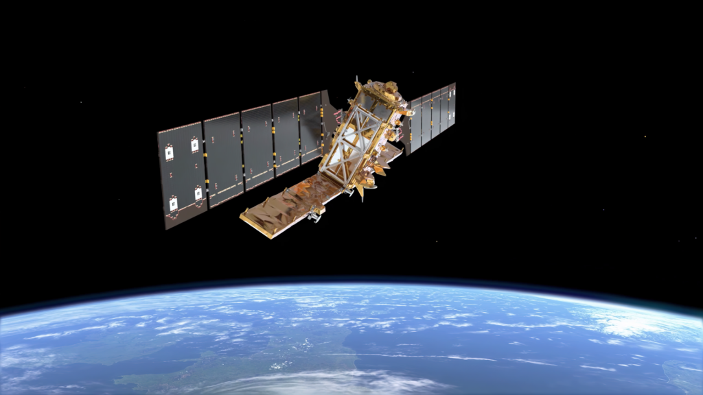
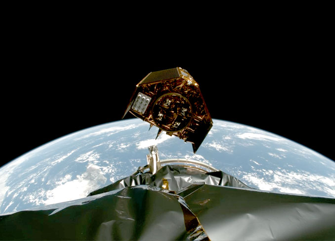
The latest guardian of our oceans has taken its place in orbit. The Copernicus Sentinel-6B satellite is now circling Earth, ready to continue a decades-long mission to track the height of the planet’s seas – a key measure of climate change.
Like its predecessor, Sentinel-6 Michael Freilich, Sentinel-6B carries the latest radar altimetry technology to further extend the sea-surface height record that began in the early 1990s. These measurements help scientists understand sea-level rise – crucial information for shaping climate policy and protecting the millions of people living in coastal areas around the world.
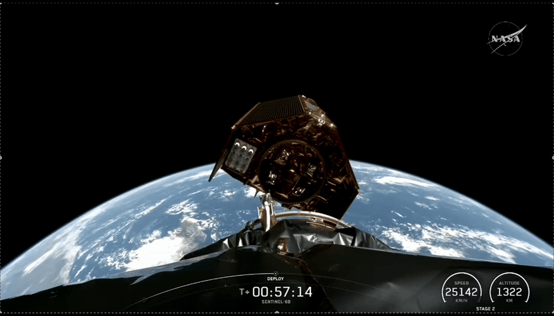
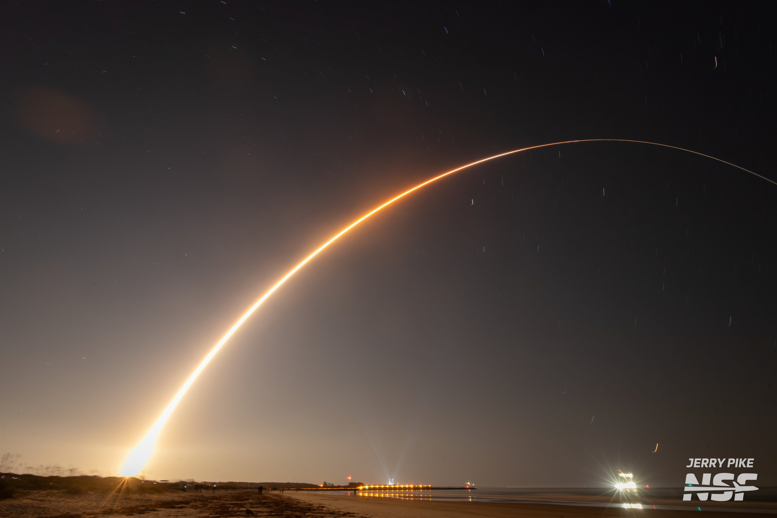
Sentinel-6B launched today, 17 November, at 06:21 CET aboard a SpaceX Falcon 9 rocket from Vandenberg Space Force Base in California. The satellite was delivered into orbit just under an hour after liftoff, and at 07:54 CET ESA’s European Space Operations Centre in Germany received the all-important signal via the Inuvik ground station in Canada, indicating that Sentinel-6B is alive and well.
Sentinel-6B is set to carry forward the legacy of Sentinel-6 Michael Freilich, launched in November 2020. The Sentinel-6 mission serves as the world’s primary reference mission for satellite sea-surface height measurements.
The continuous record of observations began in the early 1990s with the French–US Topex-Poseidon satellite and continued with the Jason series of satellite missions.
With sea-level rise high on the global agenda, numerous organisations have worked to make Copernicus Sentinel-6 the gold-standard reference mission for extending the record of sea-surface height measurements – delivering data with greater precision than ever before.
Although part of the European Union’s family of Copernicus missions, Sentinel-6 is the product of exceptional international cooperation, involving the European Commission, ESA, NASA, Eumetsat and NOAA, with additional support from the French space agency CNES.
ESA’s Director of Earth Observation Programmes, Simonetta Cheli, said, “Collaboration between partners is key to a mission such as Sentinel-6, and my thanks go to everyone involved in developing, launching and operating this exceptional satellite, which follows in the footsteps of the first Sentinel-6, Michael Freilich.
“This achievement demonstrates what can be accomplished when international agencies and industries work together toward a shared goal. Sentinel-6B will ensure that we continue to collect the high-precision data needed to understand our changing climate, safeguard our oceans and support decisions that protect coastal communities around the world.”
As well as mapping the height of the sea surface to understand long-term change, Copernicus Sentinel-6 also provides data for practical ‘operational’ applications. For example, the mission measures significant wave height and wind speed, data that are used for near-real time ocean forecasting.
In fact, satellite altimetry provides the most comprehensive ocean sea-state measurements available today.
The Sentinel-6 satellites carry an altimeter that works by measuring the time it takes for radar pulses to travel to Earth’s surface and back again to the satellite. Combined with precise satellite location data, altimetry measurements yield the height of the sea surface.
The satellites’ instrument package also includes an advanced microwave radiometer provided by NASA. Water vapour in the atmosphere affects the speed of the altimeter’s radar pulses – and therefore estimates of sea-surface height.
The advanced microwave radiometer accounts for this water vapour to ensure that measurements are accurate.
Sentinel-6B is now under the care of ESA’s mission control in Germany, where the team is taking the satellite through its ‘Launch and Early Orbit Phase’. Once this has been completed, control of the satellite will be handed over to Eumetsat.


Related Posts
Stay Informed With the Latest & Most Important News
Previous Post
Next Post


Advertisement
-
 01Two Black Holes Observed Circling Each Other for the First Time
 -
 02From Polymerization-Enabled Folding and Assembly to Chemical Evolution: Key Processes for Emergence of Functional Polymers in the Origin of Life
 -
 03Astronomy 101: From the Sun and Moon to Wormholes and Warp Drive, Key Theories, Discoveries, and Facts about the Universe (The Adams 101 Series)
 -
 04True Anomaly hires former York Space executive as chief operating officer
 -
 05Φsat-2 begins science phase for AI Earth images
 -
 06Hurricane forecasters are losing 3 key satellites ahead of peak storm season − a meteorologist explains why it matters
 -
 07Binary star systems are complex astronomical objects − a new AI approach could pin down their properties quickly