
Now Reading: Watch: HydroGNSS, IRIDE and Greek mission satellites launch
-
01
Watch: HydroGNSS, IRIDE and Greek mission satellites launch


18/11/2025
761 views
14 likes
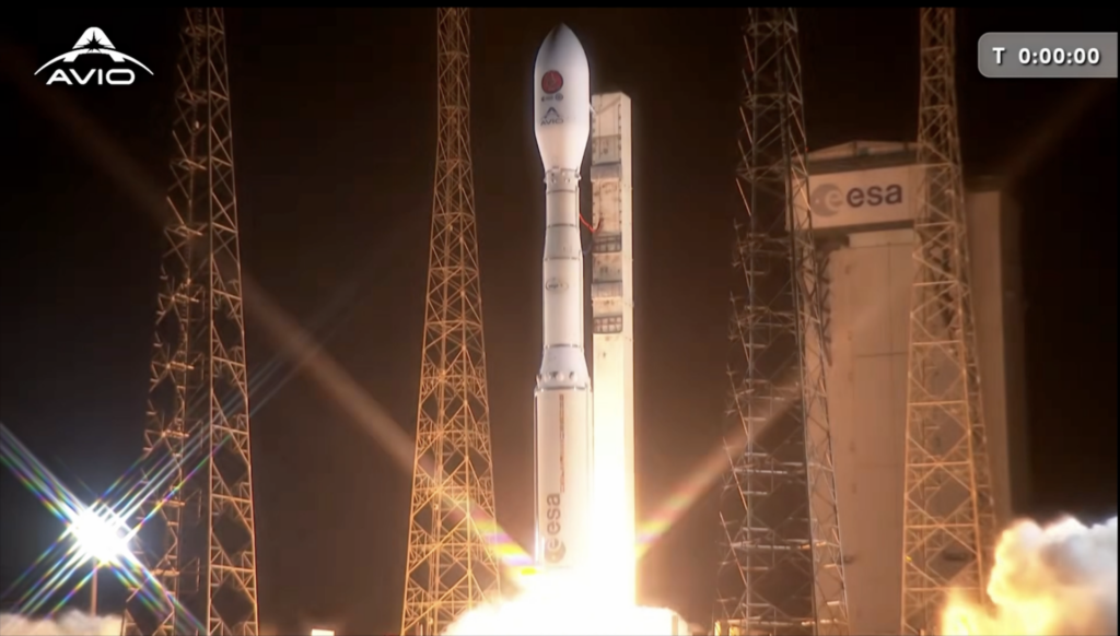
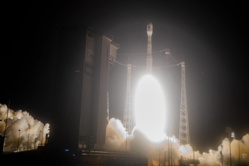
The European Space Agency’s HydroGNSS, a twin-satellite mission to gather data on Earth’s water cycle, is scheduled to launch on 19 November at 19:18 CET (10:18 Pacific Time). Live coverage of the launch will be shown on ESA Web TV.
The live coverage will start at 19:01 CET (10:01 Pacific Time). Launch is from the Vandenberg Space Force Base with SpaceX on Falcon 9.
Please note: launch times are subject to change at short notice. This page will be updated as soon as information becomes available, so please check back or bookmark the article.
Follow the launch live
Watch the liftoff of HydroGNSS live on ESA Web TV. The rideshare on Falcon 9 also sees the launch of satellites for the Italian national mission IRIDE, as well as satellites developed by ICEYE for Greece’s National Small Satellite Programme.
Wednesday, 19 November (all times in CET):
- 19:01 Join SpaceX live webcast
- 19:18 Falcon 9 liftoff
- 21:41 Live webcast ends
Scouting for water
Changes in the global water cycle pose a threat to our environment and to communities around the world. HydroGNSS, part of ESA’s FutureEO programme, delivers observations on four hydrological parameters:
- soil moisture,
- inundation or wetlands,
- freeze/thaw state, and
- above-ground biomass.
These parameters are closely aligned with Essential Climate Variables, which measure physical, chemical, or biological characteristics and provide empirical evidence to assess climate risks. Data on these variables are used in many applications and areas of science: from weather forecasting and flood prediction, to understanding wetlands, as well as data on permafrost and forest carbon stocks. HydroGNSS will also measure wind speed over the ocean and sea-ice extent as secondary products.
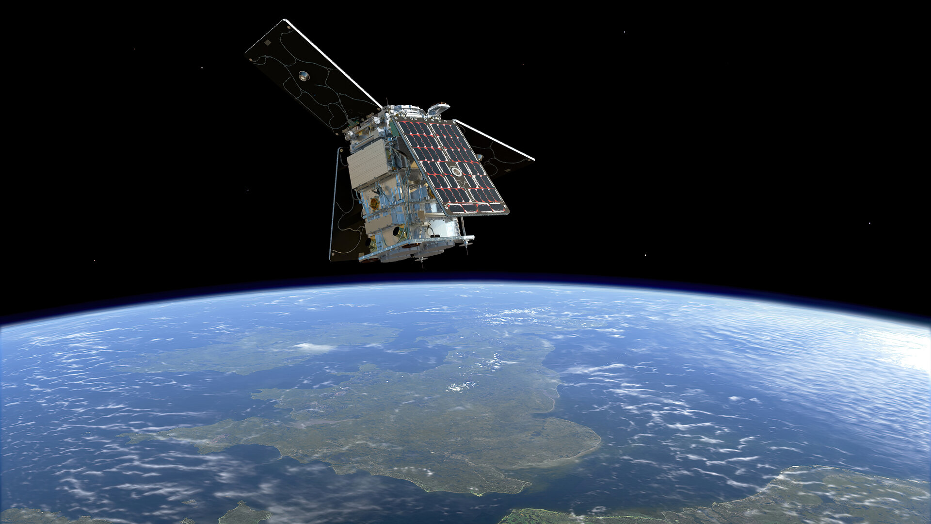
The mission will provide measurements on these water-related indicators using a technique called Global Navigation Satellite System (GNSS) reflectometry. This technique involves the signals from systems such as Galileo and GPS, which are part of the GNSS. These navigation satellites work by continually transmitting low-power L-band microwave navigation signals towards Earth. Their primary purpose is to provide global positioning, navigation, and timing services, such as the navigation systems in cars and mobile devices.
However, when the GNSS signal reflects off Earth’s surface, it is altered by the physical properties of terrain, ice, oceans or vegetation. The HydroGNSS mission obtains scientific data on the Earth’s water cycle by comparing this altered signal with the direct signals from the GNSS satellites.
The mission consists of two microsatellites, both of which carry a GNSS reflectometry instrument in an orbit of about 550km, 180 degrees apart.
Italy’s Earth observing constellations
IRIDE, which is designed to provide public sector services based on data from its fleet of Earth observation constellations, is due to launch satellites for its second constellation, Eaglet II. Each satellite in the Eaglet II constellation carries a multispectral, high-resolution optical instrument, as well as an Automatic Identification System (AIS) instrument. OHB Italia is the prime contractor for the satellites.
Eaglet II is the second of six constellations for IRIDE. The first, Hawk for Earth Observation (HEO) was launched earlier this year.
Data from the IRIDE satellites will support products such as maps, monitoring services and multi-temporal analysis. The programme provides services to Italy’s public authorities and supports Italy’s civil protection department. It is coordinated by ESA with support from the Italian Space Agency (ASI) and is funded by Italy’s National Recovery and Resilience Plan (PNRR).
Greece’s National Small Satellite Programme
The two new high-resolution ICEYE radar satellites are the first to launch under the Greek National Small Satellite Programme. This programme, which will also include other types of satellite next year, aims to enhance Greece’s satellite technology and application capabilities, foster innovation and job creation, drive economic growth, and strengthen national capacities in disaster management, environmental monitoring, and security. The project is led by the Hellenic Space Center and the Greek Ministry of Digital Governance, with ESA providing the overarching framework and supporting ICEYE in developing both satellites.


Related Posts

Stay Informed With the Latest & Most Important News
Previous Post
Next Post
Advertisement
-
 01Two Black Holes Observed Circling Each Other for the First Time
 -
 02From Polymerization-Enabled Folding and Assembly to Chemical Evolution: Key Processes for Emergence of Functional Polymers in the Origin of Life
 -
 03Astronomy 101: From the Sun and Moon to Wormholes and Warp Drive, Key Theories, Discoveries, and Facts about the Universe (The Adams 101 Series)
 -
 04True Anomaly hires former York Space executive as chief operating officer
 -
 05Φsat-2 begins science phase for AI Earth images
 -
 06Hurricane forecasters are losing 3 key satellites ahead of peak storm season − a meteorologist explains why it matters
 -
 07Binary star systems are complex astronomical objects − a new AI approach could pin down their properties quickly