
Now Reading: Satellite sees Antarctic ice shrink to 3rd-lowest max ever | Space photo of the day for Nov. 24, 2025
-
01
Satellite sees Antarctic ice shrink to 3rd-lowest max ever | Space photo of the day for Nov. 24, 2025

Satellite sees Antarctic ice shrink to 3rd-lowest max ever | Space photo of the day for Nov. 24, 2025
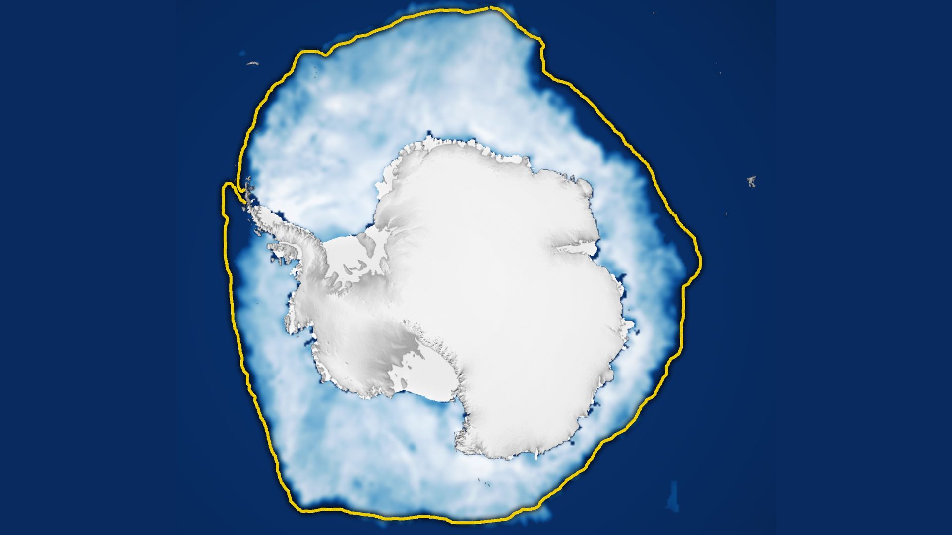
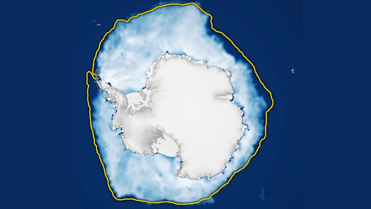
Antarctic sea ice reached its seasonal winter maximum on Sept. 17, 2025, but even at its greatest extent of the year, coverage remained strikingly low by historical standards. Satellite imagery and data highlighted by the NASA Earth Observatory show the difference between the 2025 extent and the long-term average, revealing substantial reductions around much of the Antarctic coastline.
What is it?
Antarctic sea ice plays a critical role in Earth’s climate and ecosystems, and understanding its variability is essential for interpreting broader environmental changes. Unlike the Arctic, which is an ocean surrounded by land, Antarctica is a continent surrounded by open ocean.
This geographic contrast allows Antarctic sea ice to expand freely during winter and retreat dramatically in summer, creating one of the most dynamic seasonal ice cycles on the planet. Sea ice in this region regulates climate by reflecting sunlight back into space, influences ocean circulation through the freezing and melting of saltwater, and helps shape weather patterns across the Southern Hemisphere. It also supports a rich ecosystem in which species such as penguins, seals, seabirds, and krill depend on predictable ice conditions for feeding and breeding.
Where is it?
This image was created using satellite data captured from low Earth orbit.
Why is it amazing?
For many years, Antarctic sea ice did not exhibit the long-term decline seen in the Arctic and instead fluctuated around or above average levels. However, that pattern shifted abruptly after 2016, when successive years began to show historically low extents in both winter and summer.
Now, satellite measurements show that the ice expanded to just 6.88 million square miles (17.81 million square kilometers) this southern winter, making it the third-lowest winter maximum in the 47-year satellite record, according to the National Snow and Ice Data Center in Boulder, Colorado. This year’s peak fell nearly 348,000 square miles (900,000 square km) below the 1981–2010 average, continuing a post-2016 pattern of unusually low sea ice.
Despite these clear departures from previous decades, researchers caution that the Antarctic climate system is highly complex, making it difficult to draw definitive conclusions about long-term change. Ocean temperatures, atmospheric circulation, wind patterns and natural climate variability all interact in ways that can influence seasonal ice formation.
Want to learn more?
You can learn more about climate change and Earth-observing satellites.


Related Posts


Stay Informed With the Latest & Most Important News
Previous Post
Next Post


Advertisement
-
 01Two Black Holes Observed Circling Each Other for the First Time
 -
 02From Polymerization-Enabled Folding and Assembly to Chemical Evolution: Key Processes for Emergence of Functional Polymers in the Origin of Life
 -
 03Astronomy 101: From the Sun and Moon to Wormholes and Warp Drive, Key Theories, Discoveries, and Facts about the Universe (The Adams 101 Series)
 -
 04True Anomaly hires former York Space executive as chief operating officer
 -
 05Φsat-2 begins science phase for AI Earth images
 -
 06Hurricane forecasters are losing 3 key satellites ahead of peak storm season − a meteorologist explains why it matters
 -
 07Binary star systems are complex astronomical objects − a new AI approach could pin down their properties quickly