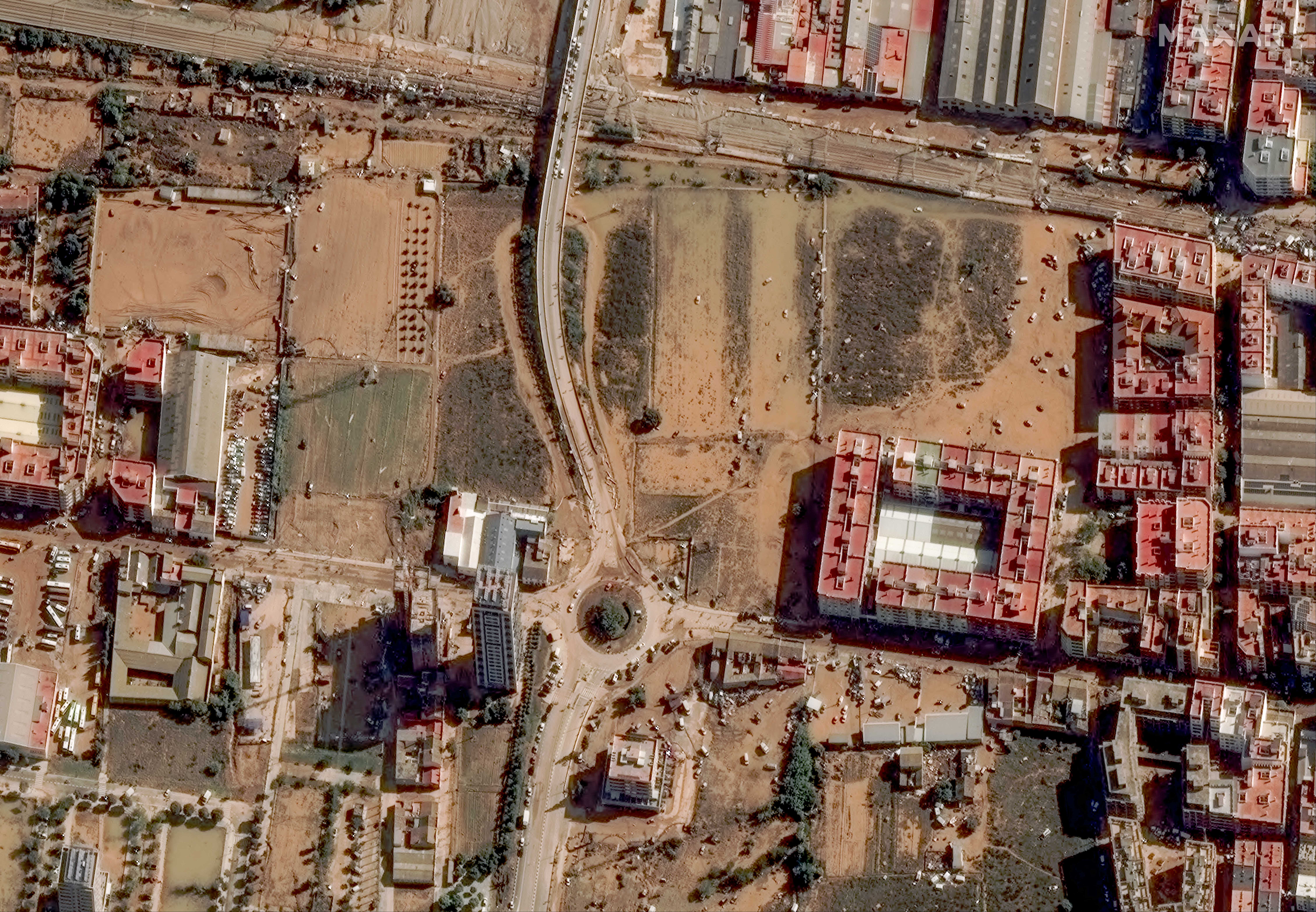
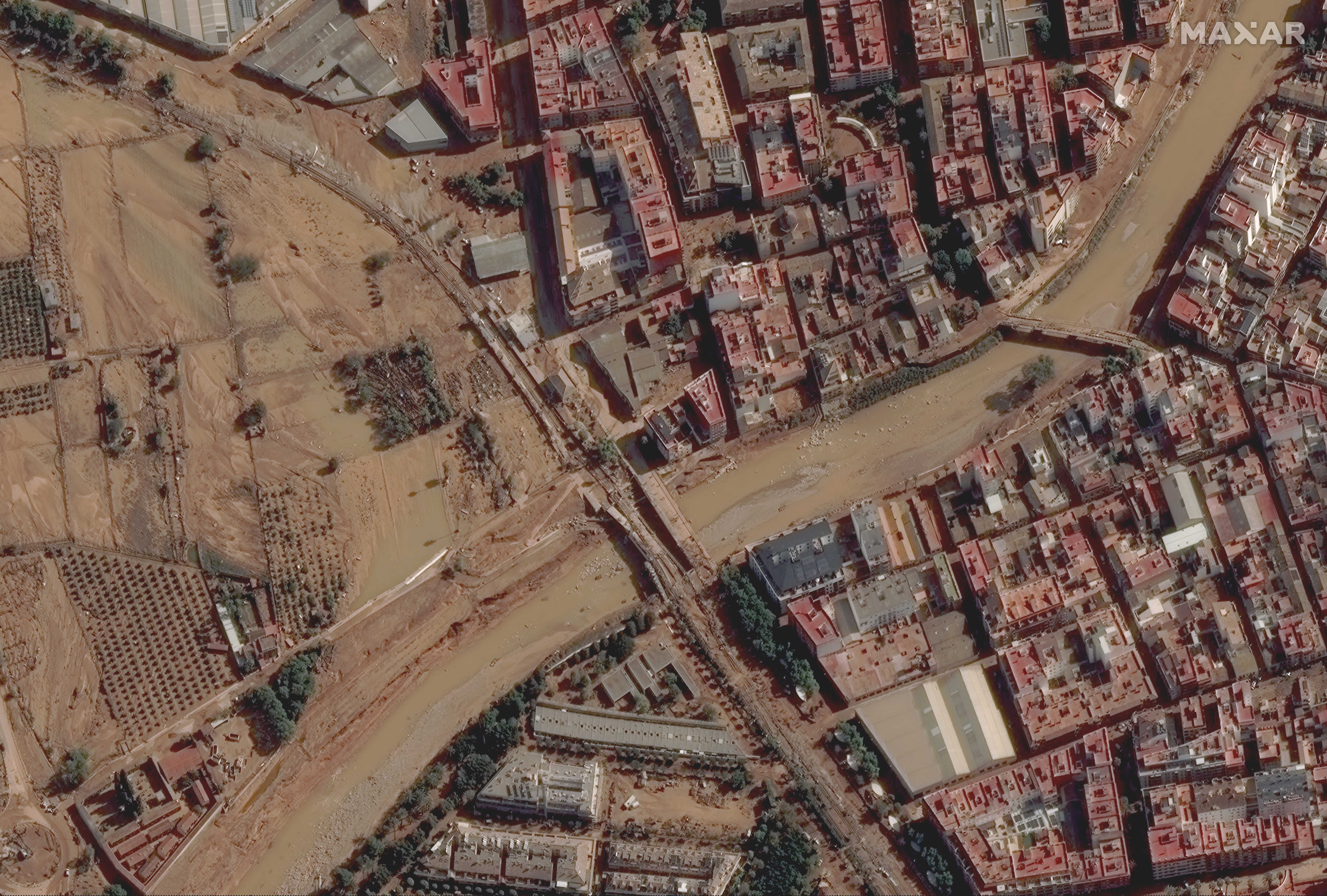
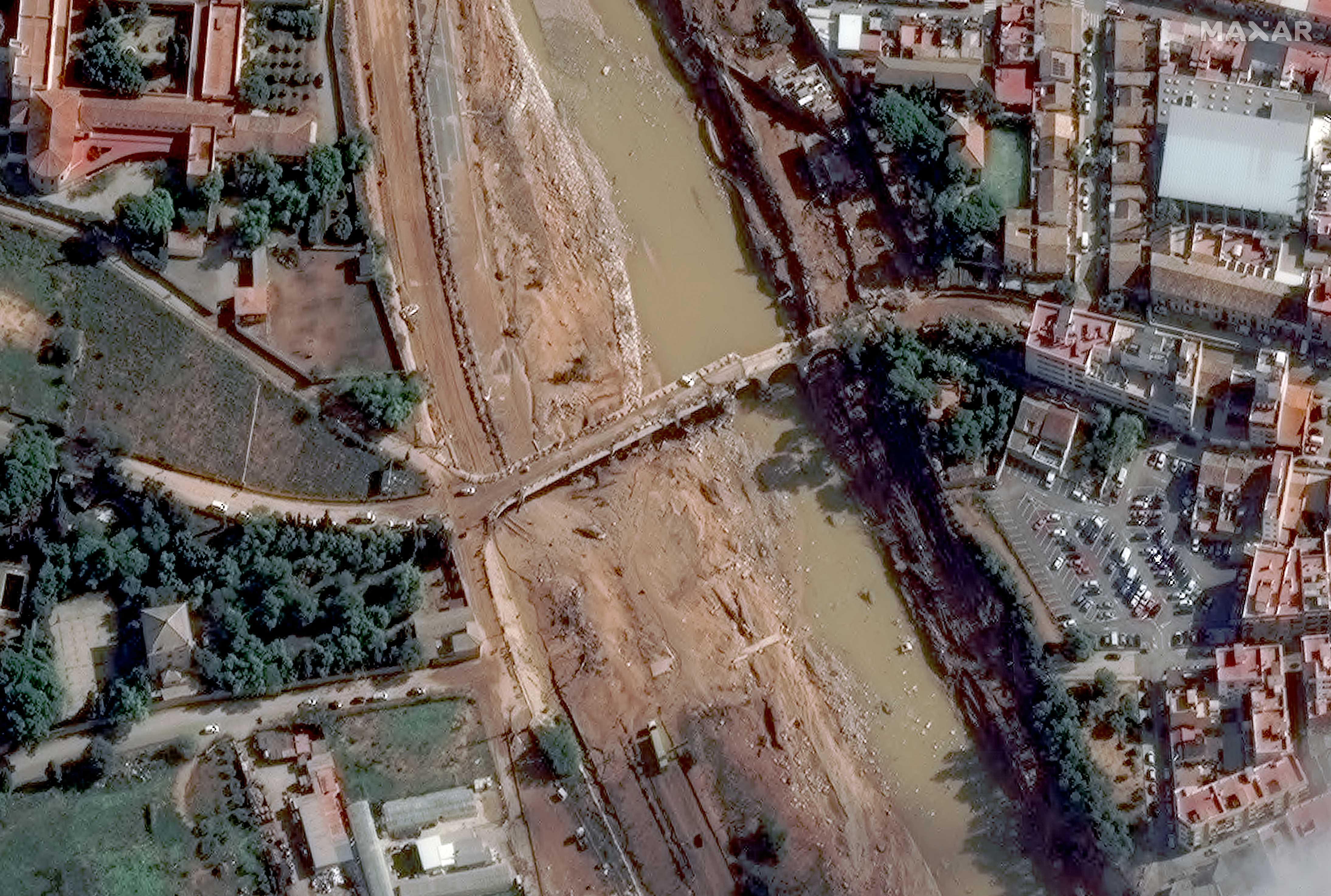
Satellite images captured deadly flooding in eastern Spain caused by torrential rainfall on Tuesday (Oct. 29).
Landsat and Maxar satellites imaged the damage, which came after the region experienced more than a foot (30 centimeters) of rain, according to Spain’s meteorological agency, AEMET.
Landsat 8’s operational land imager scrutinized the area on Wednesday (Oct. 30), tracking “sediment-laden waters” in the coastal city of Valencia, NASA officials stated. (Landsat is jointly managed by NASA and the U.S. Geological Survey.)
Related: How satellite data has proven climate change is a climate crisis
“Sediment-laden floodwaters also filled the channel of the Turia river, which empties into the Balearic Sea — part of the Mediterranean — and the L’Albufera coastal wetlands south of the city,” the NASA statement added.

Anthropogenic climate change may be partially responsible for the severity of the flood. In 2023, human activity was responsible for a whopping 1.3 degrees Celsius (2.3 degrees Fahrenheit) of warming, according to the Global Climate Change report led by the University of Leeds in the United Kingdom.

Activities such as the burning of fossil fuels create greenhouse gases like methane or carbon dioxide in Earth’s atmosphere.
These gases reduce the ability of heat to escape from our planet, which in turn is causing more extreme weather events such as flooding and hurricanes.

Roadways in Valencia are choked with mud and silt. This debris is causing “extensive traffic backups,” which “are visible on many of the major roads in the area,” Maxar representatives said in a statement.
“Transportation routes across the area,” they added, “have been significantly impacted by the flood damage as many roads, bridges and highways remain obstructed or impassable; moreover, hundreds of cars and vehicles are scattered across the flooded areas of the city and suburbs.”


