
Now Reading: Curiosity Blog, Sols 4600-4601: Up and Over the Sand Covered Ramp
-
01
Curiosity Blog, Sols 4600-4601: Up and Over the Sand Covered Ramp

2 min read
Curiosity Blog, Sols 4600-4601: Up and Over the Sand Covered Ramp

Written by Sharon Wilson Purdy, Planetary Geologist at the Smithsonian National Air and Space Museum
Earth planning date: Monday, July 14, 2025
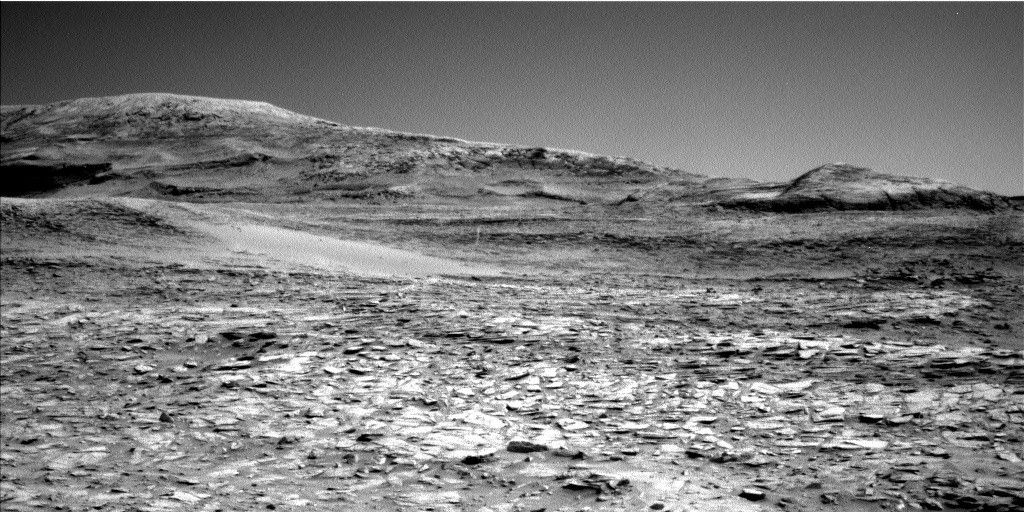
The Curiosity rover continues to navigate through the region of Mount Sharp characterized by the boxwork terrain. After successfully completing a drive of about 34 meters over the weekend (about 112 feet), the rover parked near the edge of a smooth, sandy stretch at the base of a ridge that leads to the most prominent and complex network of boxwork structures seen so far.
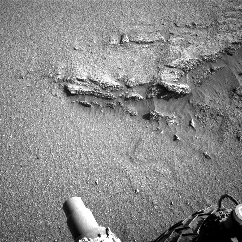
Due to the lack of exposed bedrock in the immediate workspace, the science team opted to give some of the rover’s contact science instruments a break. With the dust removal tool (DRT) and APXS instruments stowed, the extra energy allowed the Mars Hand Lens Imager (MAHLI) to take high resolution images of “Playa de la Gallina” to survey the uniform, smooth surface consisting of sand and pebble-sized material.
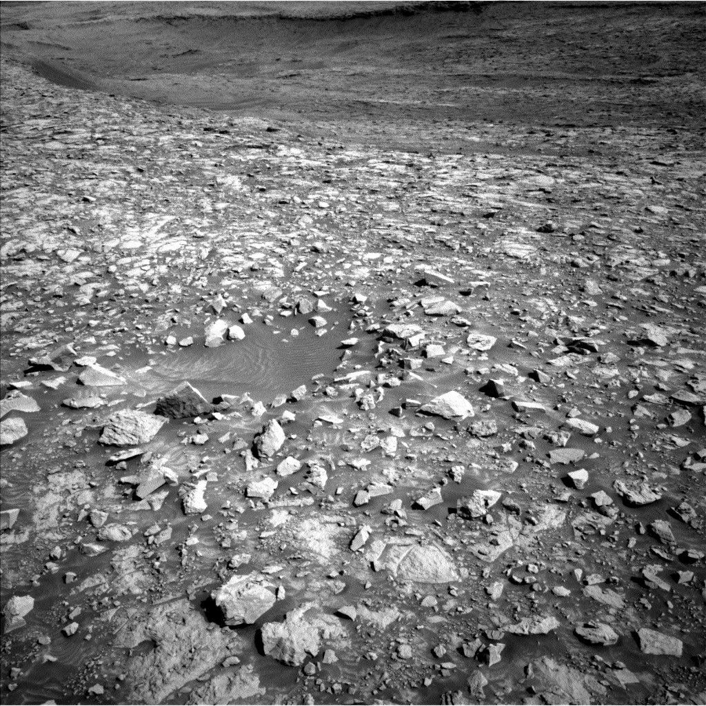
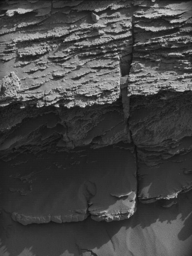
The ChemCam and Mastcam teams scheduled several observations in this two-sol plan that further investigated the rocks and structures in our immediate vicinity and surroundings. ChemCam LIBS was used to target “El Olivo” to determine the chemistry of the bumpy textured bedrock near the rover, which was also imaged by a Mastcam stereo mosaic. Additional Mastcam stereo mosaics include fractures at “El Corral” and linear troughs at “Chapare.” Further away, ChemCam’s Remote Micro Imager (RMI) will provide insight into an intriguing section of scoured features within the Mishe Mokwa butte.
The environmental working group continues to keep an eye in the sky and planned a supra-horizon movie and a dust-devil survey as part of their ongoing monitoring campaign of the atmospheric conditions in Gale Crater.
The 21-meter-long drive (about 69 feet) at the end of this plan will maneuver the rover past the sandy ramp to the top of the main boxwork region. From here, the science team will be able to explore this fascinating area of particularly large boxwork structures. Stay tuned as Curiosity continues to climb higher and delve deeper into the geologic history of Mars!
Share
Details
Related Terms
Explore More


Related Posts

Stay Informed With the Latest & Most Important News
Previous Post
Next Post


Advertisement
-
 01Two Black Holes Observed Circling Each Other for the First Time
 -
 02From Polymerization-Enabled Folding and Assembly to Chemical Evolution: Key Processes for Emergence of Functional Polymers in the Origin of Life
 -
 03Astronomy 101: From the Sun and Moon to Wormholes and Warp Drive, Key Theories, Discoveries, and Facts about the Universe (The Adams 101 Series)
 -
 04True Anomaly hires former York Space executive as chief operating officer
 -
 05Φsat-2 begins science phase for AI Earth images
 -
 06Hurricane forecasters are losing 3 key satellites ahead of peak storm season − a meteorologist explains why it matters
 -
 07Binary star systems are complex astronomical objects − a new AI approach could pin down their properties quickly