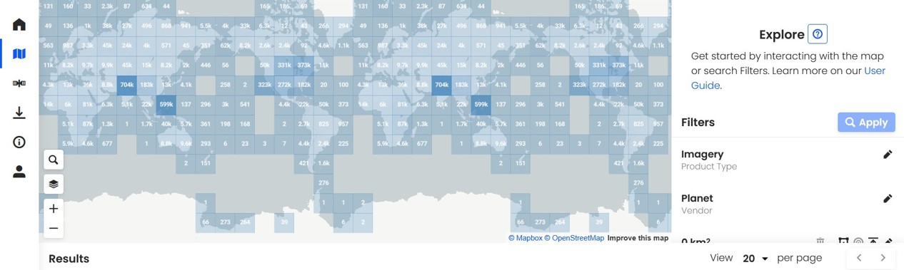
4 min read CSDA Releases New Data Acquisition Request System This screen capture of the SDX dashboard shows a map of Earth’s surface, and on the right, the search filters

4 min read CSDA Releases New Data Acquisition Request System This screen capture of the SDX dashboard shows a map of Earth’s surface, and on the right, the search filters

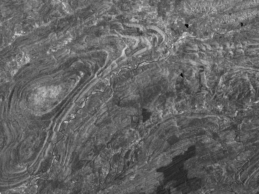
CSDA Program Announces Eight New Data Agreements This Spotlight Mode SAR image from Capella Space shows a portion of the city of Pittsburgh, Pennsylvania, on August 21, 2021. Credit: Capella
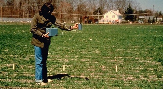
2 min read Notes from the Field Looking at Chlorophyll from Space By Compton “Jim” Tucker Tucker began his ground studies using a handheld instrument built by one of his
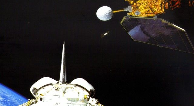
5 min read 42 Years of Measuring the Sun, the Earth and the Energy in Between By Denise Lineberry NASA’s Earth Radiation Budget Satellite (ERBS), a part of the NASA’s
6 min read The Sky Belongs to All of Us By Hashima Hasan How did a little girl born in India soon after its independence from the British Empire, become
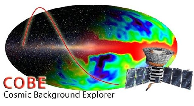
4 min read Measuring the Big Bang with the COBE satellite By John Mather The Cosmic Background Explorer satellite (COBE) went up on a Delta rocket on Nov. 18, 1989,
7 min read Peering Homeward, 1972 By Laura Rocchio The scientists and engineers at NASA Goddard looking at the first MSS images were looking at just one band of data,

Remotely operated vehicle MiniROV in a simulated environment during the training of the Deployable AI developed as part of the Deployable Artificial Intelligence for Exploration and Discovery in the Deep
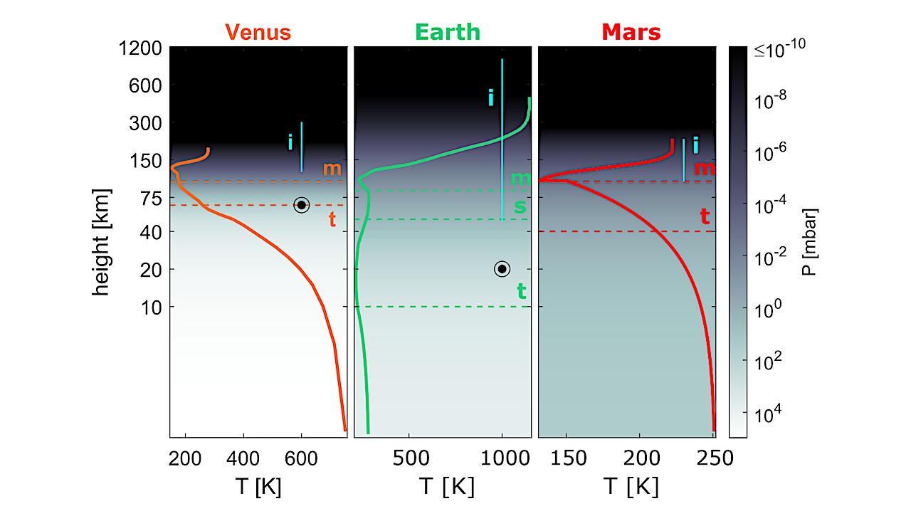
Height scales of atmospheres of Solar System’s terrestrial planets. The solid lines show the temperature profiles against altitude, while the background color reflects the atmospheric pressure. Horizontal dashed lines denote
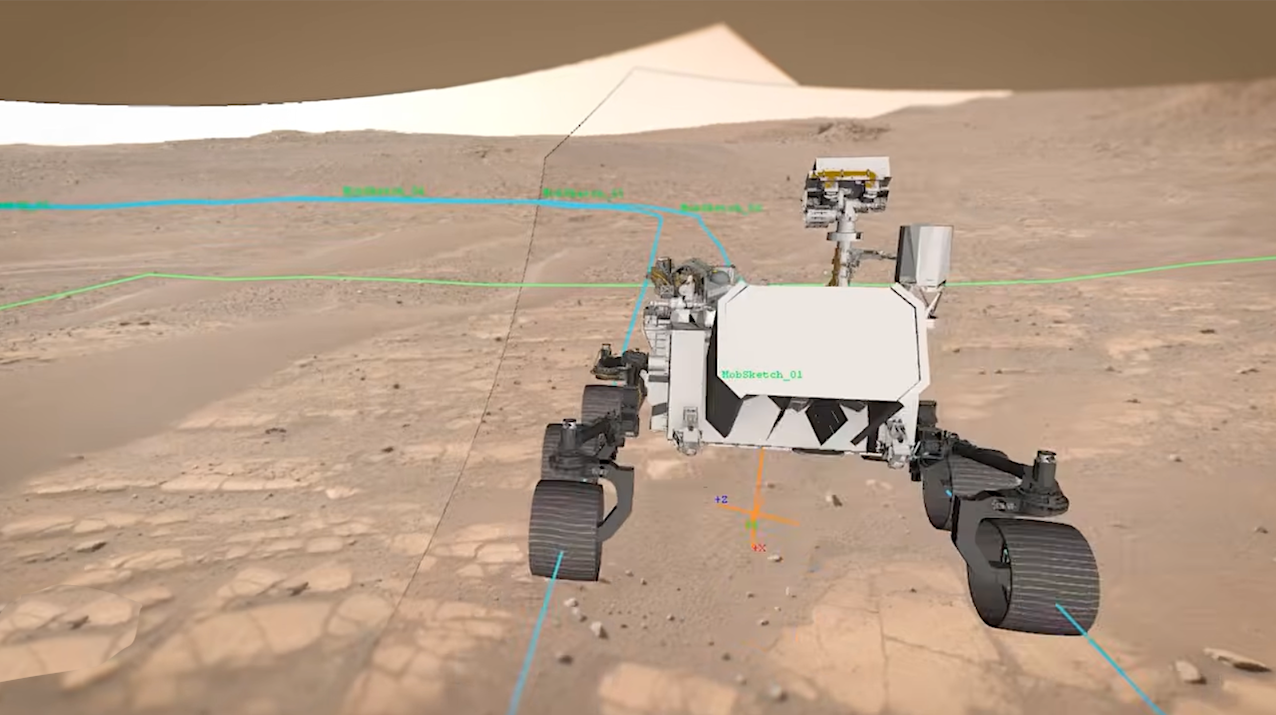
There is no GPS at the Red Planet, but a new technology called Mars Global Localization lets Perseverance determine precisely where it is — without human help. — NASA Imagine