
4 min read Digital Surface and Terrain Models from Vantor’s Precision3D Product Line Added to Satellite Data Explorer NASA’s Commercial Satellite Data Acquisition (CSDA) Program announces the addition of three

4 min read Digital Surface and Terrain Models from Vantor’s Precision3D Product Line Added to Satellite Data Explorer NASA’s Commercial Satellite Data Acquisition (CSDA) Program announces the addition of three
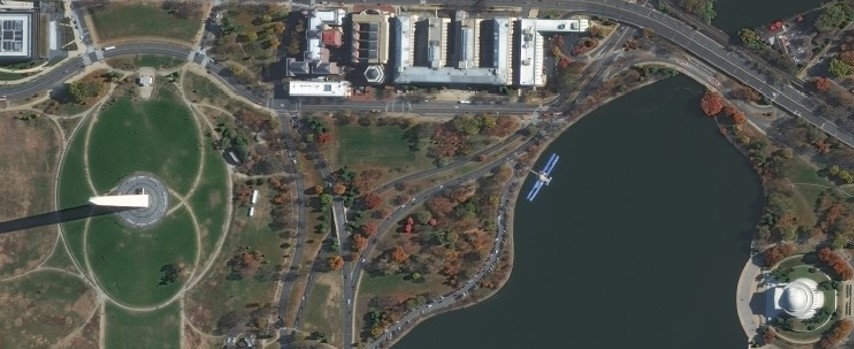
4 min read Vantor Archive Imagery Added to Satellite Data Explorer A high-resolution multispectral image of Washington, DC from Vantor. Visible are the Washington Monument (left), Tidal Basin (the body
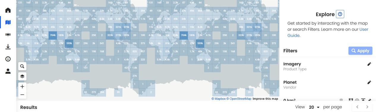
4 min read CSDA Releases New Data Acquisition Request System This screen capture of the SDX dashboard shows a map of Earth’s surface, and on the right, the search filters
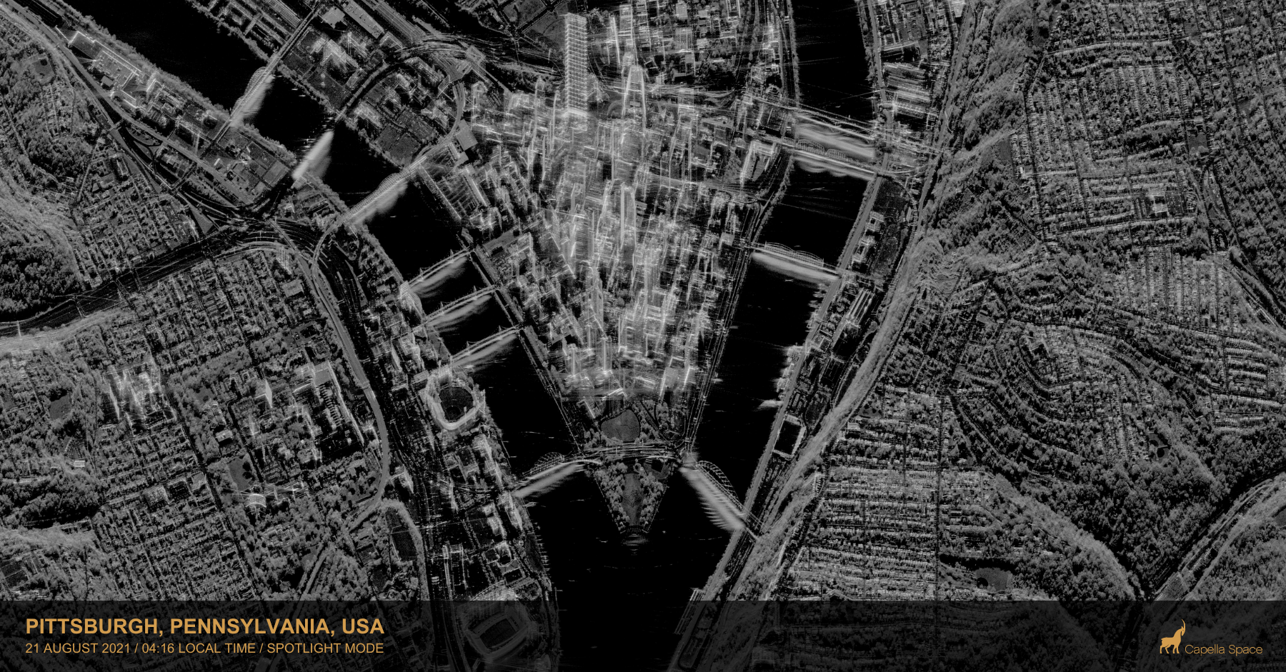
CSDA Program Announces Eight New Data Agreements This Spotlight Mode SAR image from Capella Space shows a portion of the city of Pittsburgh, Pennsylvania, on August 21, 2021. Credit: Capella

2 min read Notes from the Field Looking at Chlorophyll from Space By Compton “Jim” Tucker Tucker began his ground studies using a handheld instrument built by one of his

5 min read 42 Years of Measuring the Sun, the Earth and the Energy in Between By Denise Lineberry NASA’s Earth Radiation Budget Satellite (ERBS), a part of the NASA’s
6 min read The Sky Belongs to All of Us By Hashima Hasan How did a little girl born in India soon after its independence from the British Empire, become
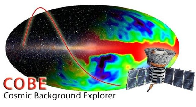
4 min read Measuring the Big Bang with the COBE satellite By John Mather The Cosmic Background Explorer satellite (COBE) went up on a Delta rocket on Nov. 18, 1989,
7 min read Peering Homeward, 1972 By Laura Rocchio The scientists and engineers at NASA Goddard looking at the first MSS images were looking at just one band of data,
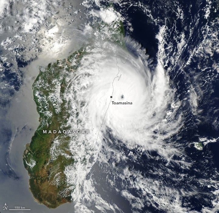
Earth Observatory Science Earth Observatory A Second Cyclone Slams Madagascar Earth Earth Observatory Image of the Day EO Explorer Topics All Topics Atmosphere Land Heat & Radiation Life on Earth