A niche corner of the commercial space sector is attracting attention from United States national security planners, not because of its economic promise, but because of the technical problems it

A niche corner of the commercial space sector is attracting attention from United States national security planners, not because of its economic promise, but because of the technical problems it
WASHINGTON — Quindar, a startup that provides mission management software for satellite operators, has been selected by satellite servicing company Starfish Space to support the first three missions of its

WASHINGTON — Voyager Technologies and Max Space, a company working on expandable habitats, plan to work together to see how that technology could be used for lunar exploration. The companies

TAMPA, Fla. — Logos Space Services has secured U.S. regulatory approval to deploy up to 4,178 low Earth orbit broadband satellites. The Federal Communications Commission partially granted the Redwood City,

Few modern systems are as consequential — or as exposed — as the Global Positioning System. A temporary loss of access to its positioning, navigation and timing signals would ripple

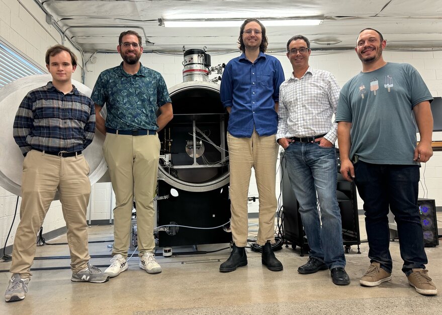
Correction: Morpheus Space is ramping up to producing 100 GO-2 propulsion systems annually. SAN FRANCISCO — Morpheus Space raised $15 million in a Series A+ funding round announced Feb. 5.
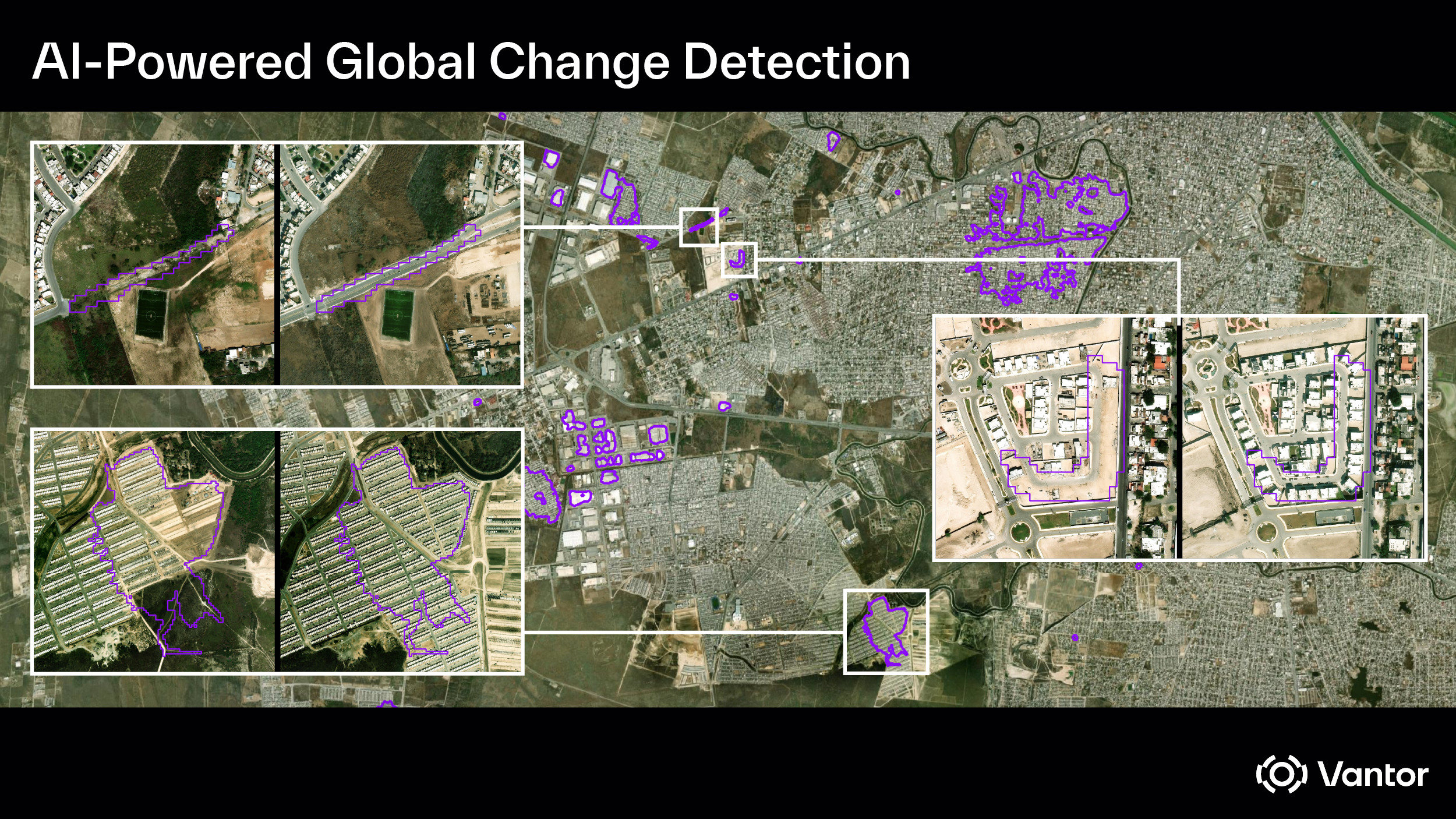
WASHINGTON — Vantor, a commercial Earth observation satellite operator, said Feb. 5 it won a $5.3 million contract from the National Geospatial-Intelligence Agency to detect and deliver automated insights on

WASHINGTON — The House Science Committee unanimously approved a NASA authorization bill Feb. 4 after adopting dozens of amendments. The committee voted 37-0 to favorably report the NASA Reauthorization Act
SAN FRANCISCO — Viridian Space Corp. signed a cooperative research and development agreement (CRADA) with the Air Force Research Laboratory. The five-year CRADA will provide the Southern California startup with access
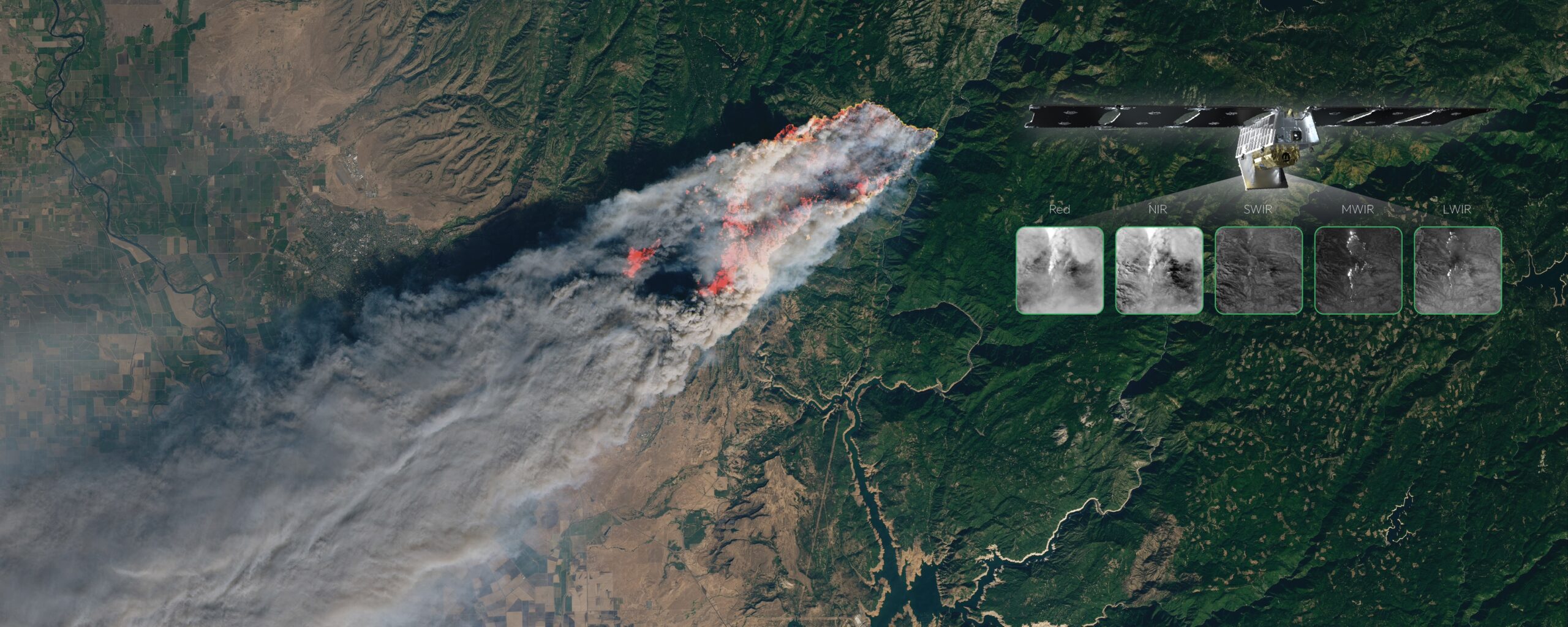
WASHINGTON — Developers of wildfire-detection satellites are moving beyond raw data delivery, adding tools that show firefighters and researchers when satellites will actually pass over the areas they are watching.