
Now Reading: ESA unveils longest-ever dataset on forest biomass
-
01
ESA unveils longest-ever dataset on forest biomass


02/05/2025
286 views
6 likes
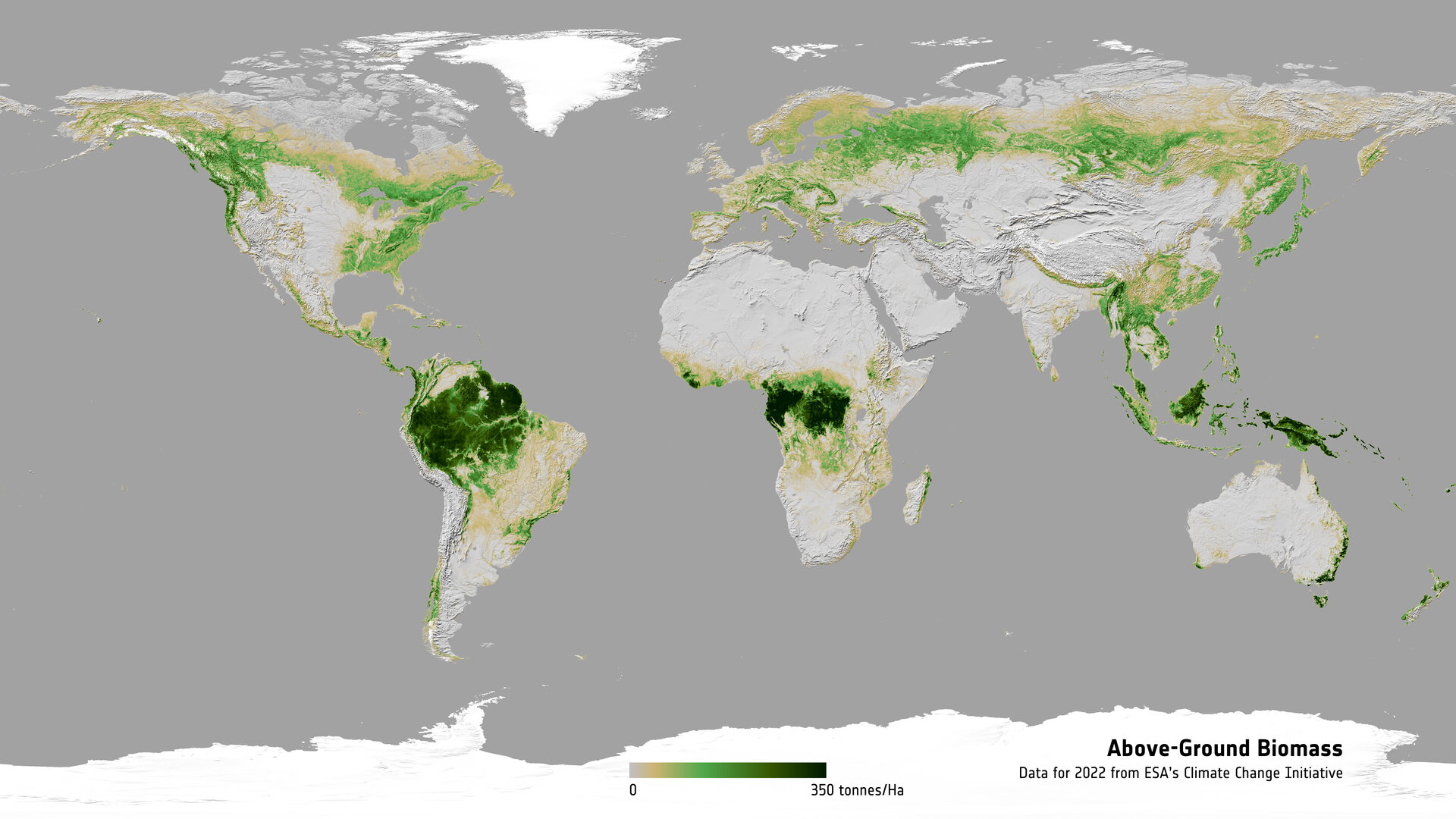
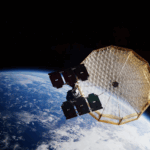
As the new Biomass satellite settles into life in orbit following its launch on 29 April, ESA has released its most extensive satellite-based maps of above-ground forest carbon to date. Spanning nearly two decades, the dataset offers the clearest global picture yet of how forest carbon stocks have changed over time.
Developed through ESA’s Climate Change Initiative, this new long-term record integrates data from multiple satellite missions – and will soon be further enhanced by data from the Biomass mission itself.
It tracks the carbon-rich woody parts of vegetation, mainly trunks and branches, across the globe for different years between 2007 and 2022, at resolutions ranging from 100 m to 50 km.
Importantly, it is tailored to support climate and carbon modelling, forest management, and national greenhouse-gas reporting activities as part of the United Nations Framework Convention on Climate Change Paris Agreement.
ESA’s Frank Martin Seifert, noted, “The new release, version 6, is a pivotal moment for climate science as it provides an unprecedented level of consistency and timeliness in the provision of above-ground biomass estimates globally.
“This empowers researchers and policymakers alike to track carbon dynamics with the temporal precision necessary for meaningful climate action.”
Trees play a vital role in the global carbon cycle, storing large amounts of carbon as biomass. While this carbon stock increases as forests grow, it can be rapidly released back into the atmosphere through deforestation and wildfires – contributing significantly to rising carbon dioxide levels and, therefore, driving climate change.
The dataset draws from different Earth-observing satellites including ESA’s Envisat and Europe’s Copernicus Sentinel-1, Japan’s ALOS PALSAR, and NASA’s ICESat and GEDI lidar missions.
Thanks to close international collaboration, particularly with the Japan Aerospace Exploration Agency, this latest release significantly improves on the accuracy of biomass estimates and corrects long-standing underestimates in high-biomass regions.
Refinements to the biomass retrieval algorithm have resulted in a dataset that delivers more consistent and reliable information across the world’s forest biomes – though it remains most accurate up to 400 tonnes of biomass per hectare.
Richard Lucas of Aberystwyth University, who leads ESA’s Climate Change Initiative Biomass Project, said, “The new dataset provides a much more accurate representation of global forest biomass, particularly in regions where earlier versions underestimated high-density forests.”
However, Prof. Lucas added that challenges remain in capturing the most carbon-rich ecosystems.
“Detecting biomass densities above 400 tonnes per hectare is considerably more difficult because the relatively short wavelengths of current radar sensors don’t fully penetrate or interact with the larger woody components of dense tropical forests.”
Maurizio Santoro, from Gamma Remote Sensing in Switzerland, added, “When assessed against independent reference data from all over the world, the new maps are of higher quality.
“Nevertheless, better characterisation of the states and dynamics of carbon stored in vegetation is still necessary, which will be facilitated by ingesting additional satellite data from past missions, and from future satellites.”
Enter ESA’s Biomass mission, which is set to transform how we assess the planet’s forest carbon stores.
Equipped with the first spaceborne P-band radar, which has a wavelength of around 70 cm, this pioneering satellite will be capable of penetrating thick forest canopies to measure the carbon locked in even the densest vegetation.
It promises to drastically reduce uncertainties in forest carbon estimates, especially in tropical regions such as the Amazon, Central Africa, and Southeast Asia.
“We hope and anticipate that data from the Biomass mission, once available, will be able to extend the record of biomass stored in the world’s forests, with this reducing uncertainties in the global carbon cycle and its contribution to climate change,” added Prof. Lucas.
The ESA Climate Change Initiative Biomass Dataset Version 6 is free and open: access here.
Read more: How Biomass the mission will be used in the Climate Change Initiative Biomass Project.


Related Posts


Stay Informed With the Latest & Most Important News
Previous Post
Next Post


Advertisement
-
 01Two Black Holes Observed Circling Each Other for the First Time
 -
 02From Polymerization-Enabled Folding and Assembly to Chemical Evolution: Key Processes for Emergence of Functional Polymers in the Origin of Life
 -
 03Astronomy 101: From the Sun and Moon to Wormholes and Warp Drive, Key Theories, Discoveries, and Facts about the Universe (The Adams 101 Series)
 -
 04True Anomaly hires former York Space executive as chief operating officer
 -
 05Φsat-2 begins science phase for AI Earth images
 -
 06Hurricane forecasters are losing 3 key satellites ahead of peak storm season − a meteorologist explains why it matters
 -
 07Binary star systems are complex astronomical objects − a new AI approach could pin down their properties quickly