
Now Reading: Europe’s next-generation weather satellite sends back first images
-
01
Europe’s next-generation weather satellite sends back first images


27/01/2026
306 views
0 likes
The first images from the Meteosat Third Generation-Sounder satellite have been shared at the European Space Conference in Brussels, showing how the mission will provide data on temperature and humidity, for more accurate weather forecasting over Europe and northern Africa.
The images from Meteosat Third Generation-Sounder (MTG-S) show a full-disc image of Earth as seen from geostationary orbit, about 36 000 km above Earth’s surface. These images were captured by the satellite’s Infrared Sounder instrument.
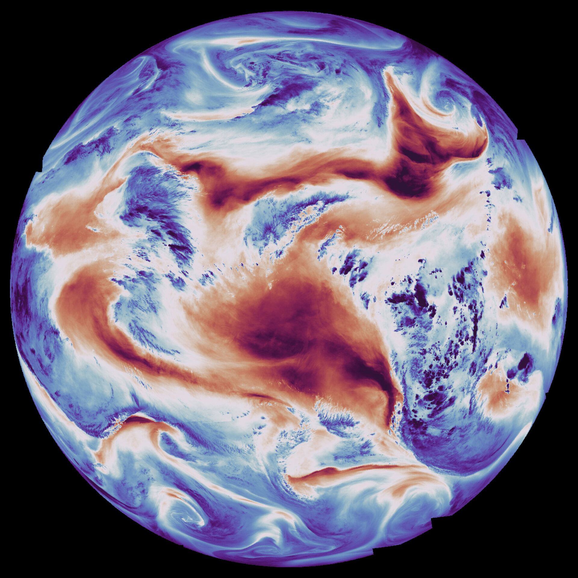
In the ‘temperature’ image (below), the Infrared Sounder used a long-wave infrared channel, which measured Earth’s surface temperature as well as the temperature at the top of clouds. Dark red corresponds to high temperatures, mainly on the warmer land surfaces, while blue corresponds to lower temperatures, typically on the top of clouds.
As would be expected, most of the warmest (dark red) areas in this image are on the continents of Africa and South America. In the top-centre of the image, the outline of the coast of western Africa is clearly visible in dark red, with the Cape Verde peninsula, home to Senegal’s capital Dakar, visible as among the warmest areas in this image. In the bottom-right of the image, the western coast of Namibia and South Africa are also visible in red beneath a swirl of cold cloud shown in blue, while the northeast coast of Brazil is visible in dark red on the left of the image.
The ‘humidity’ image (below) was captured using the Infrared Sounder’s medium-wave infrared channel, which measures humidity in Earth’s atmosphere. Blue colours correspond to regions in the atmosphere with higher humidity, while red colours correspond to lower humidity in the atmosphere.
The outlines of landmasses are not visible in this image. The areas of least atmospheric humidity, shown in dark red, are seen approximately over the Sahara Desert and the Middle East (top of image), while a large area of ‘dry’ atmosphere also covers part of the South Atlantic Ocean (centre of image). Numerous patches of high humidity are seen in dark blue over the eastern part of the African continent as well as in high and low latitudes.
Below we see a close-up from MTG-Sounder of the European continent and part of northern Africa. Like the first image above, here we see heat from land surfaces and temperatures at the top of clouds. The heat from the African continent is seen in red in the lower part of the image, while a dark blue weather front covers Spain and Portugal. The Italian peninsula is in the centre of the image.
And the animation (below) uses data from the MTG-Sounder satellite to track the eruption of Ethiopia’s Hayli Gubbi volcano on 23 November 2025. The background imagery shows surface temperature changes while infrared channels highlight the developing ash plume. The satellite’s timely observations enable tracking of the evolving ash plume over time.
Next-generation weather forecasting
MTG is a world-class Earth observation mission developed by the European Space Agency (ESA) with European partners to address scientific and societal challenges. The mission provides game-changing data for forecasting weather and air quality over Europe.
The satellite’s geostationary position above the equator means it maintains a fixed position relative to Earth, following the same area on the planet’s surface as we rotate. This enables it to provide coverage of Europe and part of northern Africa on a 15-minute repeat cycle. It supplies new data on temperature and humidity over Europe every 30 minutes, supplying meteorologists with a complete weather picture of the region and complementing data on cloud formation and lightning from the MTG-Imager (MTG-I) satellite.
ESA’s Director of Earth Observation Programmes, Simonetta Cheli, said, “Seeing the first Infrared Sounder images from the MTG-Sounder satellite really brings this mission and its potential to life. We expect data from this mission to change the way we forecast severe storms over Europe – and this is very exciting for communities and citizens, as well as for meteorologists and climatologists. As ever, the outstanding work done by our teams in collaboration with long-standing partners, including Eumetsat, the European Commission and dozens of European industry teams, means we now have the ability to predict extreme weather events in more accurate and timely ways than ever before.”
A hyperspectral view over Europe
The Infrared Sounder instrument on board MTG-S is the first European hyperspectral sounding instrument in geostationary orbit. It is designed to generate a completely new type of data product. It uses interferometric techniques, which analyse miniscule patterns in light waves, to capture data on temperature and humidity, as well as being able to measure wind and trace gases in the atmosphere. The data will eventually be used to generate three-dimensional maps of the atmosphere, helping to improve the accuracy of weather forecasting, especially for nowcasting rapidly evolving storms.
“It’s fantastic to see the first images from this groundbreaking mission,” said James Champion, ESA’s MTG Project Manager. “This satellite has been 15 years in development and will revolutionise weather forecasting and especially nowcasting. The ability to vertically profile the full Earth’s disk with a repeat cycle of only 30 minutes for Europe is an incredible accomplishment!”
“I’m excited that we can share these first images from the Infrared Sounder, which showcase just a small selection of the 1700 infrared channels continuously acquired by the instrument as it observes Earth,” said Pieter Van den Braembussche, MTG System and Payload Manager at ESA. “By combining all 1700 channels, we will soon be able to generate three dimensional maps of temperature, humidity and even trace gases in the atmosphere. This capability will offer a completely new perspective on Earth’s atmosphere, not previously available in Europe, and is expected to help forecasters predict severe storms earlier than is possible today.”
About MTG-Sounder
The MTG mission currently has two satellites in orbit: MTG-I and MTG-S. The second Imager will be launched later in 2026.
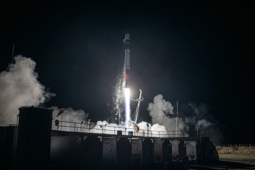
MTG-S was launched on 1 July 2025. Thales Alenia Space is the prime contractor for the overall MTG mission, with OHB Systems responsible for the MTG-Sounder satellite. Mission control and data distribution are managed by Eumetsat.
The MTG-S satellite also hosts the Copernicus Sentinel-4 mission, which consists of an ultraviolet, visible and near-infrared (UVN) imaging spectrometer. Sentinel-4 delivered its first images last year.


Related Posts

Stay Informed With the Latest & Most Important News
Previous Post
Next Post


Advertisement
-
 01Two Black Holes Observed Circling Each Other for the First Time
 -
 02From Polymerization-Enabled Folding and Assembly to Chemical Evolution: Key Processes for Emergence of Functional Polymers in the Origin of Life
 -
 03Astronomy 101: From the Sun and Moon to Wormholes and Warp Drive, Key Theories, Discoveries, and Facts about the Universe (The Adams 101 Series)
 -
 04True Anomaly hires former York Space executive as chief operating officer
 -
 05Φsat-2 begins science phase for AI Earth images
 -
 06Hurricane forecasters are losing 3 key satellites ahead of peak storm season − a meteorologist explains why it matters
 -
 07Binary star systems are complex astronomical objects − a new AI approach could pin down their properties quickly