
Now Reading: New satellite constellation will scan the entire Earth every 20 minutes to find wildfires
-
01
New satellite constellation will scan the entire Earth every 20 minutes to find wildfires

New satellite constellation will scan the entire Earth every 20 minutes to find wildfires
Three months after Muon Space launched its FireSat Protoflight satellite, the spacecraft’s first images have been released.
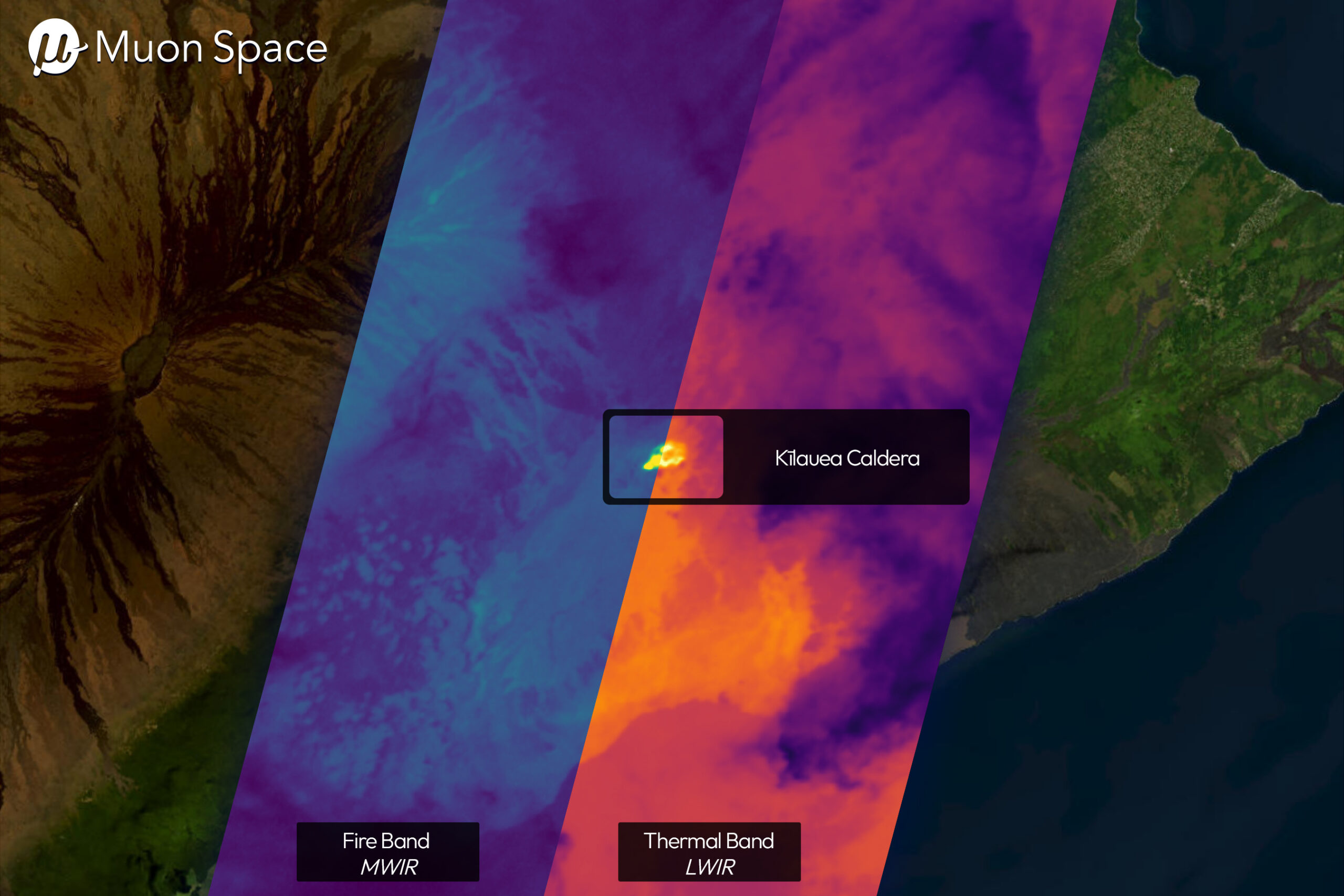
FireSat is the first in a proposed constellation of more than 50 satellites that Muon Space hopes to use to monitor and detect wildfires. These first images were taken from low-Earth orbit, as the satellite used its multi-band infrared (IR) instrument to scan the landscape for specific heat signatures that could be indicative of wildfires.
“These first light images confirm that our IR sensors are operating as designed and collecting high-quality data,” said Dan McCleese, Chief Scientist of Muon Space in a statement. “Infrared imaging with this quality is one of the most technically demanding domains in remote sensing, and we’re proud to be among the few commercial players advancing this capability in orbit.”
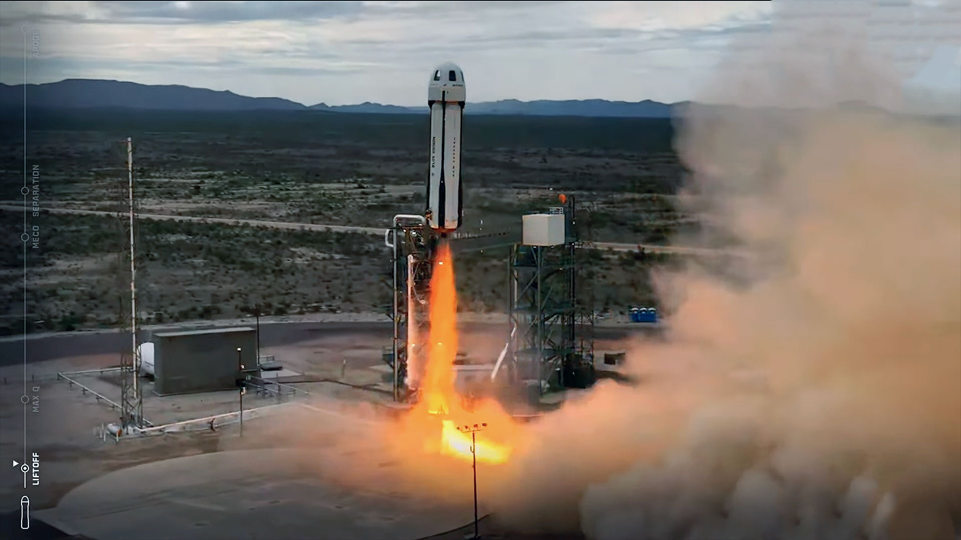
The FireSat Protoflight was launched on March 14 from Vandenberg Space Force Base as part of SpaceX’s Transporter 13 mission. Muon Space plans to launch the first block of three more FireSat satellites in 2026, with the completed constellation fully operational by 2030.
Muon Space plans for the constellation to be able to scan every point on Earth every 20 minutes, with more wildfire prone areas being scanned more frequently.
The FireSat constellation was born from a collaboration between Muon Space and the nonprofit Earth Fire Alliance to provide more in depth data on wildfires for policymakers, first responders, and affected communities to try to better mitigate the threats of wildfires. The team hopes that their high-resolution images from the satellites can help address the gap in space-based wildfire detection.

From volcanoes to oil fields
To detect specific heat sources, the FireSat scans Earth’s landscapes across the visible, near-infrared, short-, mid- and long-wave infrared bands all at the same time. These six-different IR channels allow the satellite to remove false positives and detect fires at cooler temperatures. From its position in low-Earth orbit, FireSat can detect smaller fires around 15 feet (5 meters) with a scanning area of width of 932 miles (1,500 km).
In its first images, FireSat shows heat signatures in rural and urban areas, including an airport runway in Sydney Australia.

FireSat also scanned more remote areas like the Kīlauea volcano in Hawaii and Libya’s Sarir oil field complex, where it could detect various gas flares.

“The FireSat first light images demonstrate Muon’s approach to building mission-optimized satellites including purpose-built instruments,” Jonny Dyer, CEO of Muon Space said in a statement. “I’m ecstatic with both the speed at which we moved from FireSat mission formulation to an orbit demonstration and the quality of the data that we are now collecting.”


Related Posts

Stay Informed With the Latest & Most Important News
Previous Post
Next Post


Advertisement
-
 01Two Black Holes Observed Circling Each Other for the First Time
 -
 02From Polymerization-Enabled Folding and Assembly to Chemical Evolution: Key Processes for Emergence of Functional Polymers in the Origin of Life
 -
 03Astronomy 101: From the Sun and Moon to Wormholes and Warp Drive, Key Theories, Discoveries, and Facts about the Universe (The Adams 101 Series)
 -
 04True Anomaly hires former York Space executive as chief operating officer
 -
 05Φsat-2 begins science phase for AI Earth images
 -
 06Hurricane forecasters are losing 3 key satellites ahead of peak storm season − a meteorologist explains why it matters
 -
 07Binary star systems are complex astronomical objects − a new AI approach could pin down their properties quickly