
Now Reading: New Sentinel-1D satellite launch enhances global Earth monitoring capabilities
-
01
New Sentinel-1D satellite launch enhances global Earth monitoring capabilities

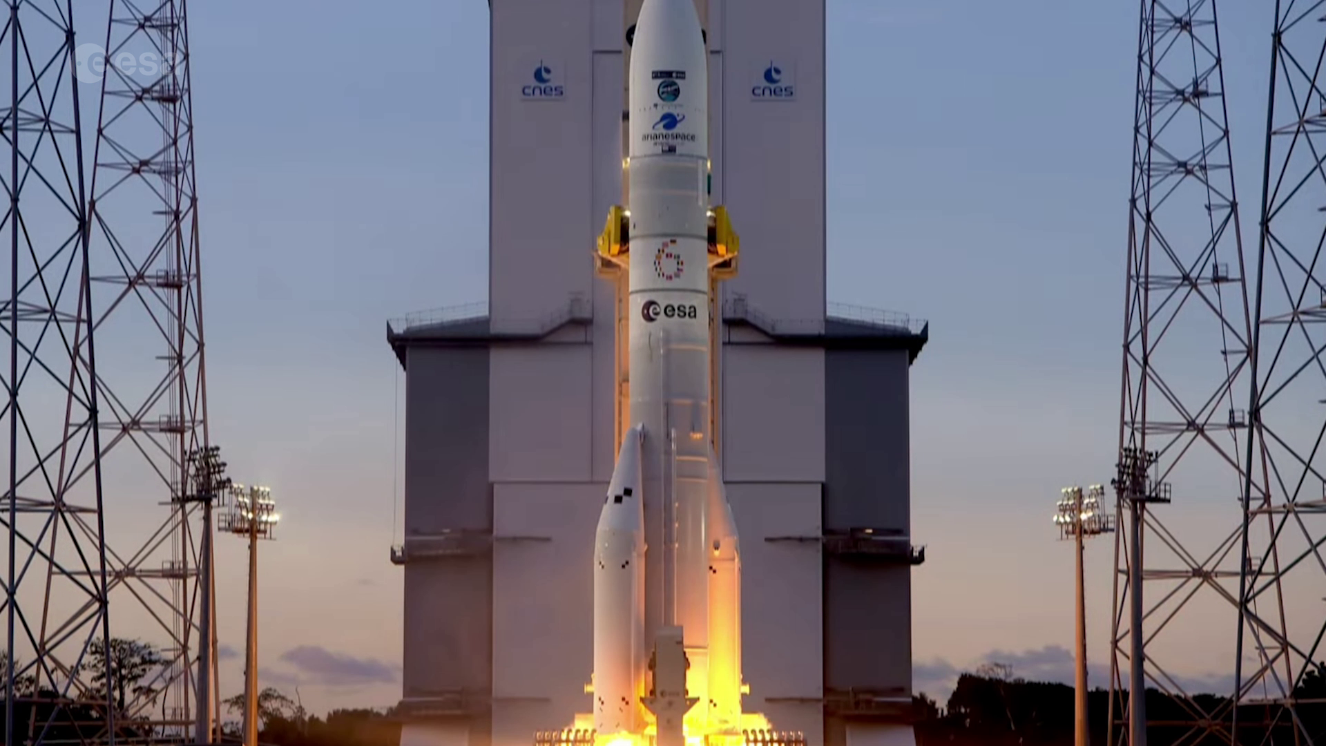

The Sentinel-1 mission has been bolstered by the successful launch of the Copernicus Sentinel-1D satellite, which took to the skies on November 4, 2025, at 22:02 CET (18:02 local time). The satellite was deployed using an Ariane 6 rocket from the European Spaceport located in French Guiana. This mission is instrumental in providing high-resolution radar imagery of the Earth’s surface, capable of operating in all weather conditions and during both day and night.
The data acquired by the Sentinel-1 satellites very important for various sectors, including disaster response organizations, environmental groups, maritime agencies, and climate researchers, who rely on timely updates to assess and manage critical situations. Sentinel-1D will complement the existing Sentinel-1C satellite, as both operate in the same orbital path but are positioned 180 degrees apart, enhancing global data acquisition and coverage.
Equipped with a C-band synthetic aperture radar (SAR) system, Sentinel-1D captures detailed images of the Earth’s terrain. It also features an Automatic Identification System (AIS) designed to enhance ship detection and tracking capabilities. Once fully operational, this new satellite will significantly enhance the frequency of AIS data collection, offering insights into vessel identities, locations, and navigation directions for more precise maritime tracking.
The launch marked flight VA265 of the Ariane 6, adding another chapter to Europe’s ongoing efforts in Earth observation and monitoring through the Copernicus program.


Related Posts
Stay Informed With the Latest & Most Important News
Previous Post
Next Post


Advertisement
-
 01Two Black Holes Observed Circling Each Other for the First Time
 -
 02From Polymerization-Enabled Folding and Assembly to Chemical Evolution: Key Processes for Emergence of Functional Polymers in the Origin of Life
 -
 03Astronomy 101: From the Sun and Moon to Wormholes and Warp Drive, Key Theories, Discoveries, and Facts about the Universe (The Adams 101 Series)
 -
 04True Anomaly hires former York Space executive as chief operating officer
 -
 05Φsat-2 begins science phase for AI Earth images
 -
 06Hurricane forecasters are losing 3 key satellites ahead of peak storm season − a meteorologist explains why it matters
 -
 07Binary star systems are complex astronomical objects − a new AI approach could pin down their properties quickly