
Now Reading: Satellite watches volcano spew ash over Middle East | Space photo of the day for Dec. 16, 2025
-
01
Satellite watches volcano spew ash over Middle East | Space photo of the day for Dec. 16, 2025

Satellite watches volcano spew ash over Middle East | Space photo of the day for Dec. 16, 2025

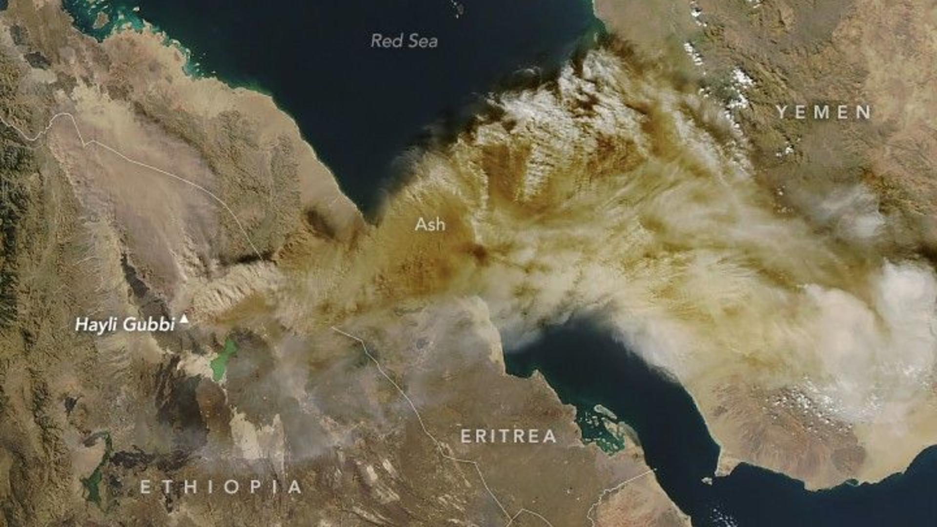
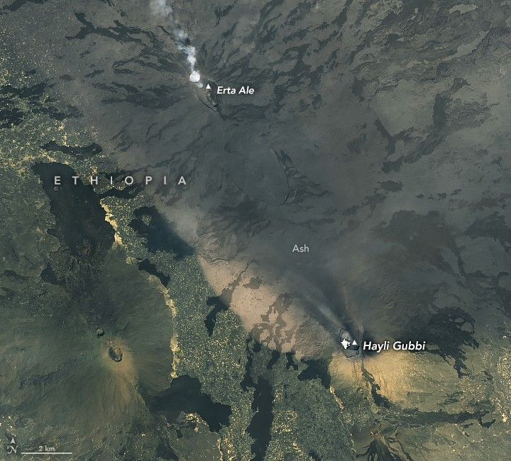
In late November, Hayli Gubbi erupted explosively, sending a towering plume of ash and volcanic gases high into the atmosphere. The MODIS instrument on NASA’s Aqua satellite captured the dramatic scene just four hours after the eruption began. The plume reached roughly 9 miles (15 kilometers) above sea level, drifting northeast across multiple countries and eventually disrupting flights as far away as India.
What is it?
Because of its remoteness, volcanic activity in the Danakil region often goes undocumented. Estimates suggest its last major activity could have occurred thousands of years ago — or perhaps only centuries, a sign of how little this environment has been studied directly.
Where is it?
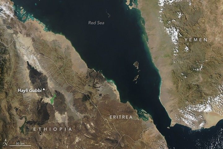
This image was taken in low Earth orbit above the Danakil region of Ethiopia.
Image 1 of 3
Why is it amazing?
Because of its understudied status, Hayli Gubbi has no recorded eruptive history in the modern era. NASA’s new satellite imagery now provides the first observational record of its activity, establishing a baseline for future monitoring and scientific analysis. Given the tectonic activity of the area, scientists can use Earth-observing satellites like Aqua to further study how plate tectonics affects Earth’s volcanic activity, providing insights about these hard-to-reach areas.
Want to learn more?
You can learn more about satellites and volcanoes.


Related Posts


Stay Informed With the Latest & Most Important News
Previous Post
Next Post


Advertisement
-
 01Two Black Holes Observed Circling Each Other for the First Time
 -
 02From Polymerization-Enabled Folding and Assembly to Chemical Evolution: Key Processes for Emergence of Functional Polymers in the Origin of Life
 -
 03Astronomy 101: From the Sun and Moon to Wormholes and Warp Drive, Key Theories, Discoveries, and Facts about the Universe (The Adams 101 Series)
 -
 04True Anomaly hires former York Space executive as chief operating officer
 -
 05Φsat-2 begins science phase for AI Earth images
 -
 06Hurricane forecasters are losing 3 key satellites ahead of peak storm season − a meteorologist explains why it matters
 -
 07Binary star systems are complex astronomical objects − a new AI approach could pin down their properties quickly