
Now Reading: Sentinel-1D delivers first images: from Antarctica to Bremen
-
01
Sentinel-1D delivers first images: from Antarctica to Bremen


26/11/2025
649 views
4 likes
The first high-resolution images have been received from Copernicus Sentinel-1D and were shared publicly for the first time at the European Space Agency’s Ministerial Council, held today in Bremen, Germany. Glaciers in Antarctica, the tip of South America, as well as the city of Bremen, are visible in these stunning radar images.
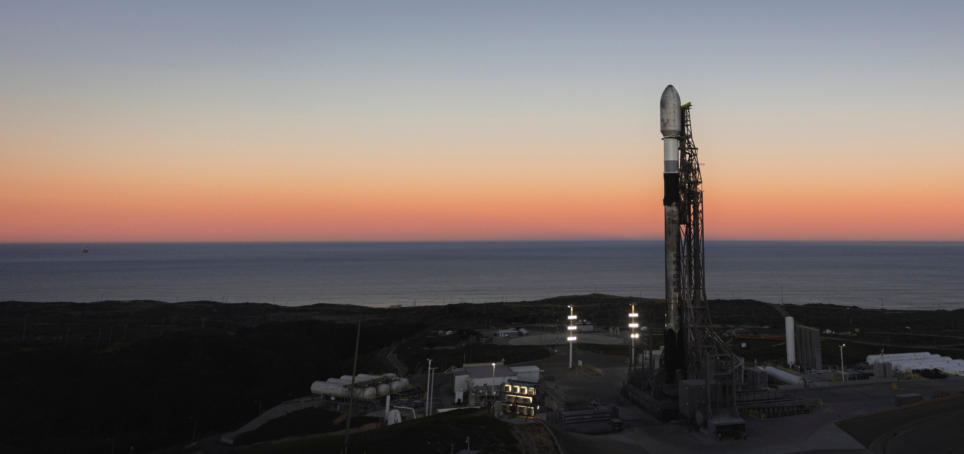
The groundbreaking Copernicus Sentinel-1 mission saw the arrival in orbit of its latest satellite earlier in November: Sentinel-1D was launched on 4 November, on board an Ariane 6 launcher from Europe’s Spaceport in French Guiana.
Once in orbit, the satellite and its instruments – it carries a 12 m-long synthetic aperture radar (SAR) instrument – were switched on, ready to capture images during a pass over the Antarctic and South America two days after launch. On the night of 6 November (European time), the first images were captured over the Antarctic Peninsula, the Tierra del Fuego and the Thwaites Glacier. Some six hours later, on the morning of 7 November, Sentinel-1D also captured images over Bremen, in Germany. The data was then transmitted, or ‘downlinked’, from the satellite to the ground station, in Matera (Italy), which is part of the Copernicus Ground Segment. All this was done within 50 hours of launch, which is likely to be the shortest time from launch to data delivery for a radar-based Earth observation satellite.
According to Nuno Miranda, ESA’s Sentinel-1 Mission Manager, the images are of unprecedented data quality for a ‘first light’ acquisition. They are very similar to the images captured not so long ago by Sentinel-1C, which, according to Nuno, is very promising for the commissioning phase. He noted, “These images have been downlinked and processed within an exceptionally short timeframe. Some of us remember that when Sentinel-1B was launched, it delivered its first radar images within two hours of activation. Sentinel-1D achieved this in an even faster time, setting what we believe is a new record for space radar. This remarkable performance reflects the dedication and exceptional preparation of all the teams involved.”
Radar instruments can image Earth’s surface through clouds, precipitation, regardless of sunlight, making them particularly well suited for monitoring polar regions. The Sentinel-1C and -1D satellites also carry an Automatic Identification System (AIS) instrument – improving the mission capacity to detect ships and sea pollution. The Sentinel-1D AIS was also activated as the satellite passed over Antarctica capturing the presence of ships in these extreme areas.
First images show fragility of glaciers
The Antarctic Peninsula (above) is part of the larger peninsula of West Antarctica, protruding 1300 km. It is an ice sheet resting on a string of rocky islands and its tip is just 1000 km from the southern tip of South America. The Antarctic Peninsula ice sheet is one of the smallest ice sheets in Antarctica but is perhaps the most vulnerable to climate change as its glaciers are small and in a region of rapid warming. Observable changes such as collapsing ice shelves, thinning and accelerating glaciers are all key indicators of climate change in the region.
This image is in black and white, showing the contrast between the ocean and the peninsula’s icy landscape.
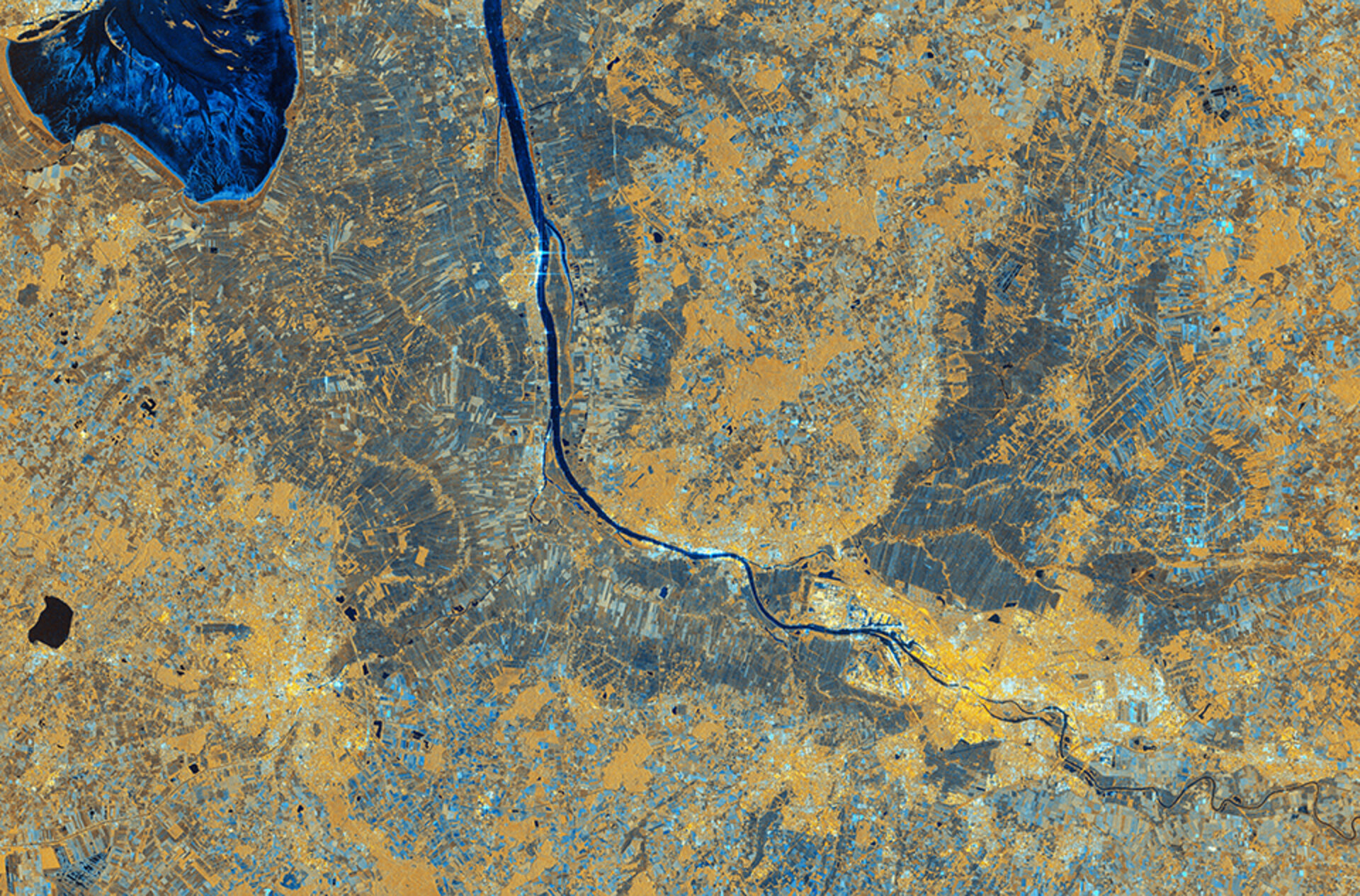
Tierra del Fuego (above) is an archipelago off the southern tip of the South American continent. It covers territory in both Argentina to the east and in Chile to the west and is separated from the mainland by the Magellan Strait. The most southerly point of Tierra del Fuego is Cape Horn.
The bright contrasting colours in this image are created by using multiple types of radar wave, known polarisations. In this image the ocean and snowy peaks are shown in shades of blue, while the land appears yellow.
The Thwaites Glacier, and the adjacent Pine Island Glacier (above), are located west of the Antarctic Peninsula. Both are vulnerable to climate change. Thwaites is one of the most unstable glaciers in Antarctica and is at risk of rapid retreat. The details shown in this image from Sentinel-1D remind us of the fragility of glaciers in the Antarctic. And since 2025 is the United Nation’s International Year of Glaciers’ Preservation, it is timely to see this image, captured on 6 November 2025.
This image also uses multiple radar polarisations to capture enhanced data on the landscape. In this image, the sea ice in the water is visible in tones of purple or violet, while the glacier appears white.
The publication of these images also follows the 30th meeting of the Conference of Parties, or COP30, where the consequences of climate change and the mitigating actions needed were discussed. The World Meteorological Organization’s State of the Climate Update for COP30 notes that glaciers, from October 2023 to September 2024, lost the largest amount of ice on record back to 1950. The report states this is equivalent to 1.2 mm of global mean sea-level rise. The report also notes that, on 24 February 2025, the extent of Antarctic sea-ice reached its third lowest extent since satellite records began in 1978, the lowest being in 2023.
Simonetta Cheli, Director of ESA’s Earth Observation Programmes, said, “This is a great achievement and I am so pleased to see these results from Sentinel-1D. It really places the data we receive from our innovative missions in the spotlight – it is data that we as a society rely upon as we continue to discuss and take action on climate change, and also data that we need in applications for understanding and studying our planet.
“The Sentinel-1 team has done an amazing job and I would like to thank everyone within ESA, together with our partners in the space industry and European institutions, for delivering work of such high quality. It’s an honour to deliver this mission for the Copernicus Earth observation programme, and we thank the Commission for their support and collaboration. We look forward also to developing the Sentinel missions of the future, to further extend the capacity and potential of Copernicus for Europe.”
ESA’s Sentinel-1 Project Manager, Ramón Torres, expressed the whole team’s pride, “Unveiling the first images from Sentinel-1D is an incredibly emotional milestone for all of us. The sense of awe and fulfilment goes beyond the thrill of liftoff itself, because seeing those breathtaking images from the SAR instrument brings our hard work to life. They are not just pictures – they are proof of our vision becoming reality, underlining how cutting-edge this mission truly is. The fact that these stunning images also confirm the satellite’s health and flawless operation fills us with relief and joy. And to have achieved all of this within an astonishingly short time – just over two days after launch – makes this moment even more unforgettable for our team.”


Related Posts
Stay Informed With the Latest & Most Important News
Previous Post
Next Post


Advertisement
-
 01Two Black Holes Observed Circling Each Other for the First Time
 -
 02From Polymerization-Enabled Folding and Assembly to Chemical Evolution: Key Processes for Emergence of Functional Polymers in the Origin of Life
 -
 03Astronomy 101: From the Sun and Moon to Wormholes and Warp Drive, Key Theories, Discoveries, and Facts about the Universe (The Adams 101 Series)
 -
 04True Anomaly hires former York Space executive as chief operating officer
 -
 05Φsat-2 begins science phase for AI Earth images
 -
 06Hurricane forecasters are losing 3 key satellites ahead of peak storm season − a meteorologist explains why it matters
 -
 07Binary star systems are complex astronomical objects − a new AI approach could pin down their properties quickly