
Now Reading: Sols 4547-4548: Taking in the View After a Long Drive
-
01
Sols 4547-4548: Taking in the View After a Long Drive

2 min read
Sols 4547-4548: Taking in the View After a Long Drive

Written by Alex Innanen, Atmospheric Scientist at York University
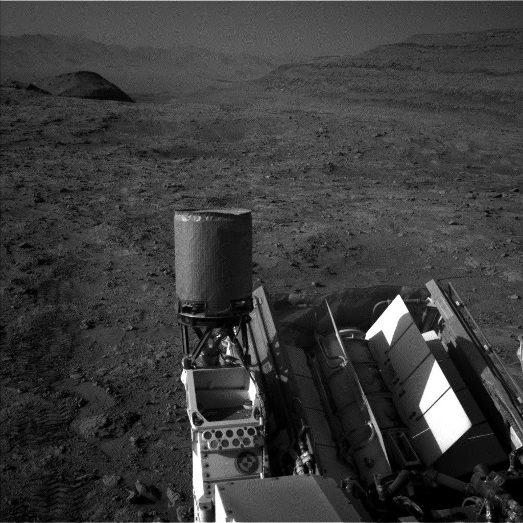
Earth planning date: Wednesday, May 21, 2025
Monday’s single-sol plan included a marathon 45-meter drive (about 148 feet), which put us in position for two full sols of imaging. This means both sols have what we call “targeted” science blocks, in which we have images of the workspace down from the last plan and can carefully choose what we want to take a closer look at. This always means a lot of good discussion amongst the geology and mineralogy theme group (GEO) about what deserves this closer look. As an outsider on the environmental theme group (ENV), I don’t always grasp the complexities of these discussions, but it’s always interesting to see what GEO is up to and to learn new things about the geology of Mount Sharp.
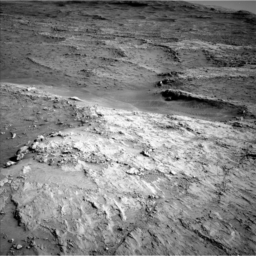
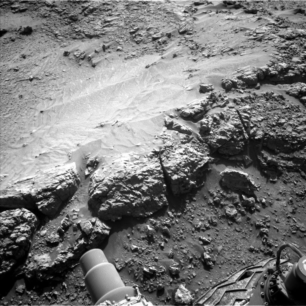
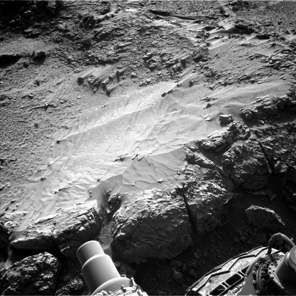
GEO ended up picking “Big Bear Lake” as our contact science target, which is getting its typical treatment from APXS and MAHLI, as well as a LIBS observation from ChemCam. Aside from that there was plenty of room for remote sensing. ChemCam is also taking a LIBS observation of “Volcan Mountains” and a long-distance mosaic of the Texoli butte. Mastcam is also taking mosaics of a nearby trough, as well as two depressions known as “Sulphur Spring,” a more distant boxwork structure, and the very distant Mishe Mokwa butte.
All of ENV’s activities are remote sensing, and we managed to squeeze in a few of those too. We have a couple dust monitoring observations, looking for dust devils and checking the amount of dust in the atmosphere. And since we’re still in the cloudy season we always try to make room for cloud observations. Today that meant a suraphorizon movie looking for clouds just above the horizon to the south, and a phase function sky survey, which captures clouds all around the rover, to try to understand how these clouds scatter sunlight.
Share
Details
Related Terms
Explore More


Related Posts


Stay Informed With the Latest & Most Important News
Previous Post
Next Post


Advertisement
-
 01Two Black Holes Observed Circling Each Other for the First Time
 -
 02From Polymerization-Enabled Folding and Assembly to Chemical Evolution: Key Processes for Emergence of Functional Polymers in the Origin of Life
 -
 03Astronomy 101: From the Sun and Moon to Wormholes and Warp Drive, Key Theories, Discoveries, and Facts about the Universe (The Adams 101 Series)
 -
 04True Anomaly hires former York Space executive as chief operating officer
 -
 05Φsat-2 begins science phase for AI Earth images
 -
 06Hurricane forecasters are losing 3 key satellites ahead of peak storm season − a meteorologist explains why it matters
 -
 07Binary star systems are complex astronomical objects − a new AI approach could pin down their properties quickly