
Now Reading: Watch Hurricane Erin swirl menacingly in the Atlantic Ocean in NOAA satellite video
-
01
Watch Hurricane Erin swirl menacingly in the Atlantic Ocean in NOAA satellite video

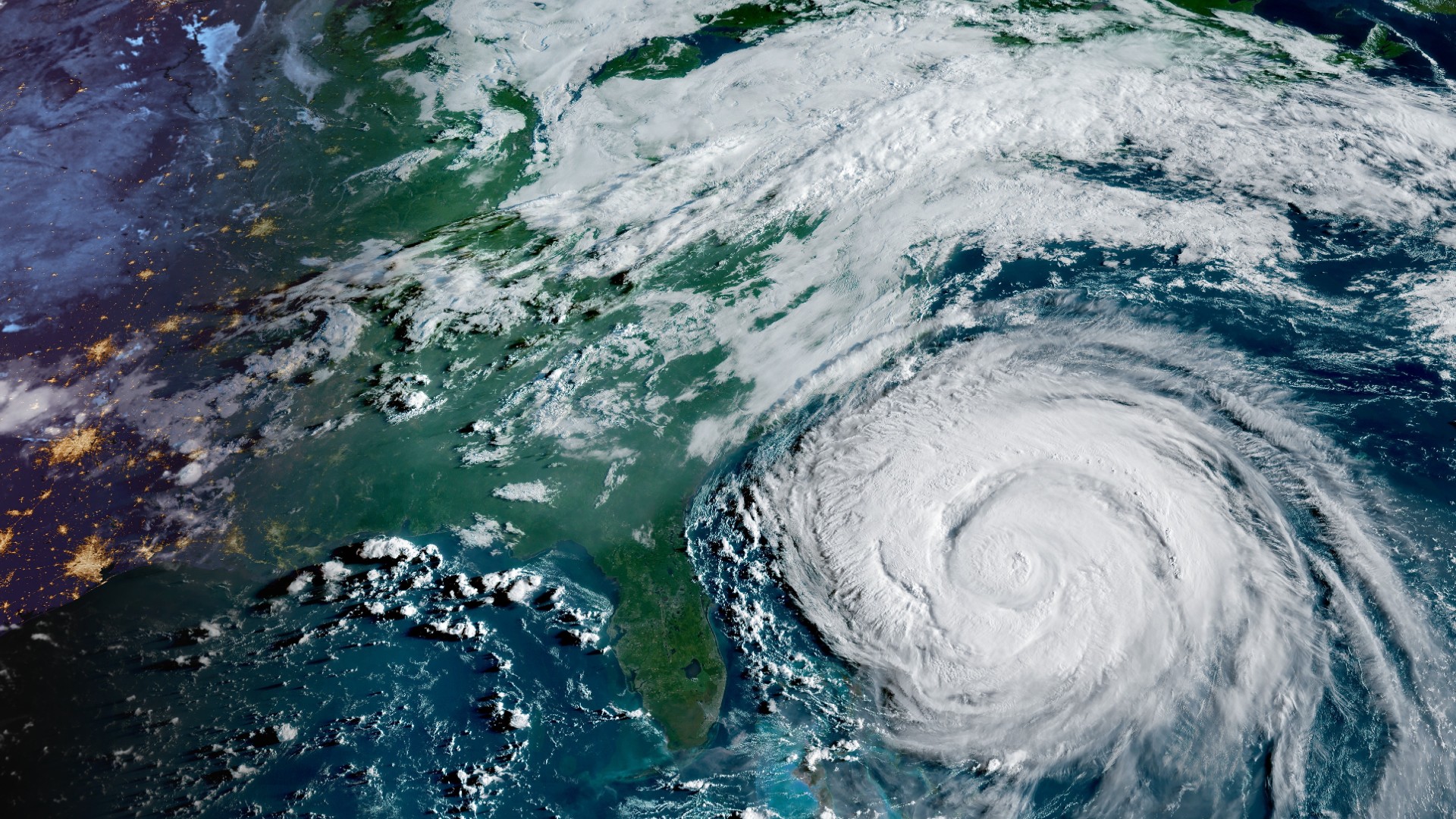
Hurricane Erin might not have made landfall in the United States, but it’s still been pretty impactful along the East Coast.
The storm might not be the strongest, spinning and moving to the northeast in the Atlantic Ocean and away from the United States, but it remains quite the beast in size and causing indirect impacts.
It’s only the fifth named storm so far of the Atlantic hurricane season, still going down in the books as the first major hurricane of the year. In a series of videos captured by GOES-19, you can see the progression of the storm and see just how far Erin’s outer bands extend.

VIDEO NOT PLAYING?
Some ad blockers can disable our video player.
Erin formed on Aug. 11, at one point rapidly intensifying into a monster Category 5 hurricane with sustained winds of 160 mph (260 km/h).
This week, the hurricane lost its wind power, weakening to a Category Two storm on the Saffir-Simpson Hurricane Wind Scale, and taking on more non-tropical characteristics as it leaves the U.S. in its rearview mirror. However, the storm left its mark and still poses concern for some coastal communities, continuing the danger of life-threatening surf, coastal flooding, and a high rip current risk from the Carolinas all the way up into the Northeast.
From space, the National Oceanic and Atmospheric Administration’s (NOAA) Geostationary Operational Environmental Satellite (GOES) satellites have been following Erin throughout its journey, helping paint a picture of the storm so we can truly understand its size and comparison to locations nearby, such as Bermuda and the coastal states.
Over time, the once symmetric and healthy-looking hurricane becomes more disorganized, losing strength and weakening in less favorable conditions.
Heading into the weekend, forecasters say as it continues to make its journey east, there will still be an on-going likelihood for hazardous conditions for the East Coast.
To stay up-to-date with the latest on Erin, you can find more details from NOAA’s National Hurricane Center.


Related Posts

Stay Informed With the Latest & Most Important News
Previous Post
Next Post


Advertisement
-
 01Two Black Holes Observed Circling Each Other for the First Time
 -
 02From Polymerization-Enabled Folding and Assembly to Chemical Evolution: Key Processes for Emergence of Functional Polymers in the Origin of Life
 -
 03Astronomy 101: From the Sun and Moon to Wormholes and Warp Drive, Key Theories, Discoveries, and Facts about the Universe (The Adams 101 Series)
 -
 04True Anomaly hires former York Space executive as chief operating officer
 -
 05Φsat-2 begins science phase for AI Earth images
 -
 06Hurricane forecasters are losing 3 key satellites ahead of peak storm season − a meteorologist explains why it matters
 -
 07Binary star systems are complex astronomical objects − a new AI approach could pin down their properties quickly