
Now Reading: Wildfires burn in northern Portugal
-
01
Wildfires burn in northern Portugal

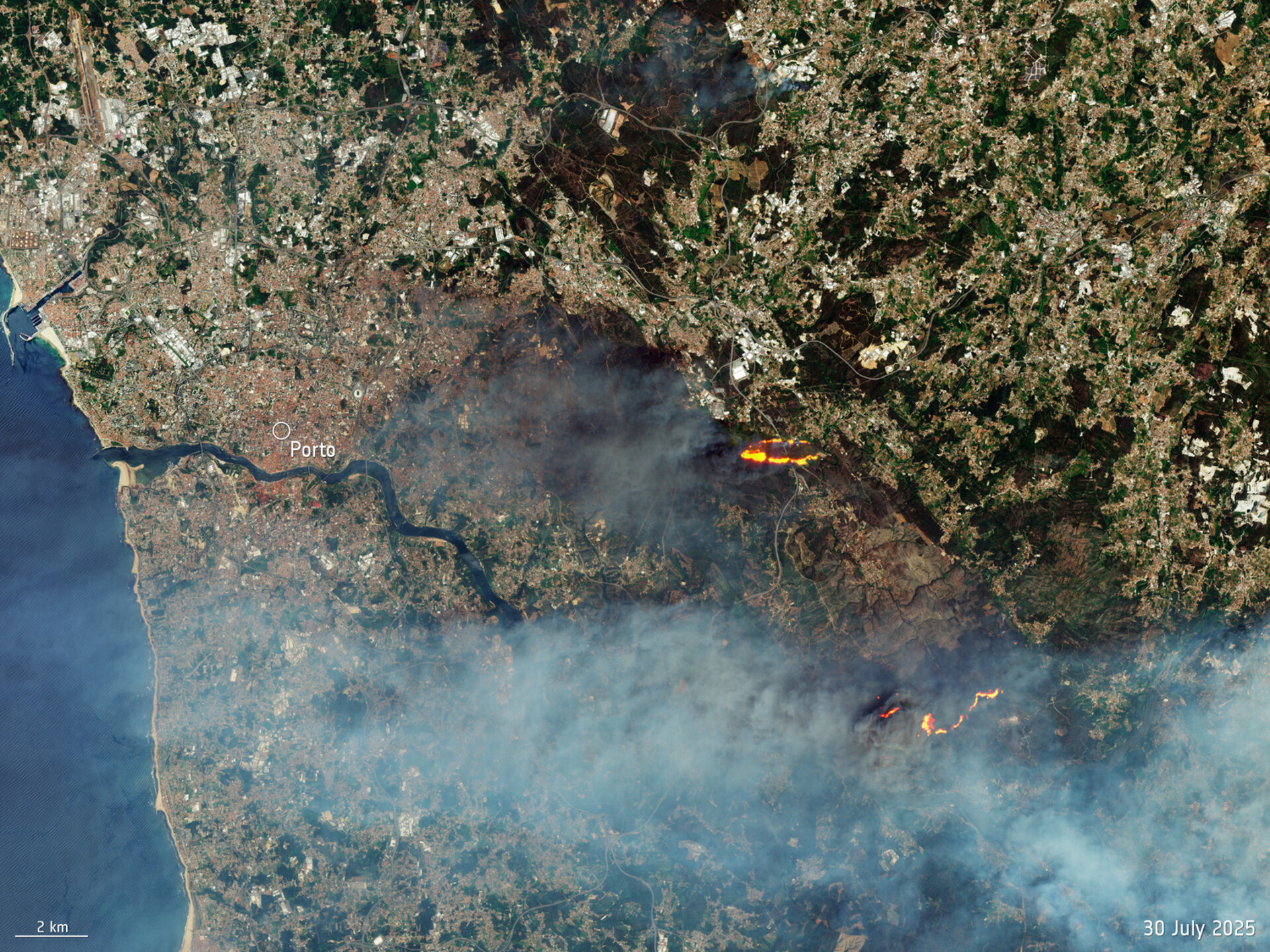

Copernicus Sentinel-2 captured wildfires burning in northern Portugal on Wednesday, 30 July.
Zoom in to explore this image at its full resolution.
The largest wildfires are in the Arouca region, a mountainous area that has outstanding geological heritage and is home to the Arouca Geopark.
This image shows two fires to the northwest of the main area affected by wildfires. Here we see a fire near the village of Recarei, about 20 km east of the city of Porto. Another fire is seen burning some 20 km south of Recarei. Grey smoke is seen drifting across the lower part of the image – blown from the fires between Castelo de Paiva and the town of Arouca, southeast of the area seen in this image.
The Copernicus Sentinel-2 mission, at an altitude of 786 km, passes over the same location on Earth every five days and is often called upon to provide data to support emergency response efforts.
An activation of the Copernicus Emergency Management Service (CEMS) has been requested to map and monitor the extent of the fires that are persistently burning in northern Portugal in the areas of Arouca and Ponte da Barca, some 80 km to the north of Porto.


Related Posts

Stay Informed With the Latest & Most Important News
Previous Post
Next Post


Advertisement
-
 01Two Black Holes Observed Circling Each Other for the First Time
 -
 02From Polymerization-Enabled Folding and Assembly to Chemical Evolution: Key Processes for Emergence of Functional Polymers in the Origin of Life
 -
 03Astronomy 101: From the Sun and Moon to Wormholes and Warp Drive, Key Theories, Discoveries, and Facts about the Universe (The Adams 101 Series)
 -
 04True Anomaly hires former York Space executive as chief operating officer
 -
 05Φsat-2 begins science phase for AI Earth images
 -
 06Hurricane forecasters are losing 3 key satellites ahead of peak storm season − a meteorologist explains why it matters
 -
 07Binary star systems are complex astronomical objects − a new AI approach could pin down their properties quickly