
Now Reading: Xplore reveals hyperspectral imagery from first satellite
-
01
Xplore reveals hyperspectral imagery from first satellite

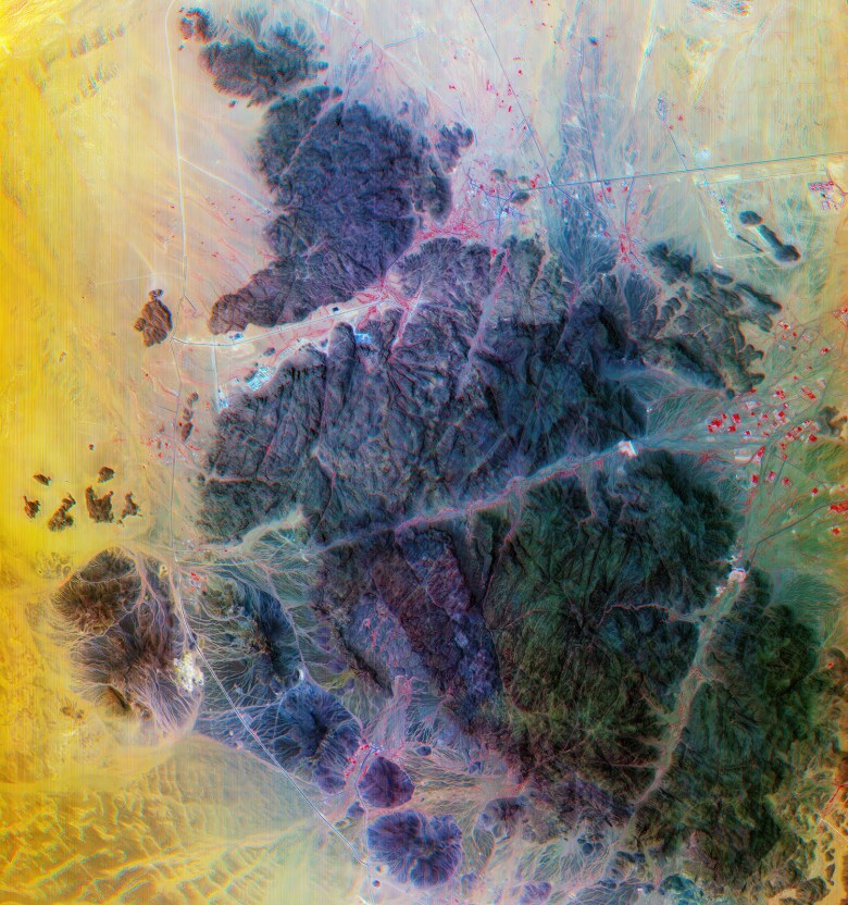
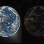
SAN FRANCISCO – Xplore Inc. unveiled hyperspectral imagery from XCUBE-1, the initial satellite in the Bellevue, Washington, startup’s remote-sensing constellation.
Since XCUBE-1 was launched in December, Xplore has “built the pipeline for tasking” imagery for its first customer under contract, Lisa Rich, Xplore founder and chief operating officer told SpaceNews. Rich declined to identify the customer.
Now, Xplore is inviting additional customers to request samples to assess hyperspectral data for programs and projects.
XCUBE-1, a six-unit cubesat, provides imagery with a resolution of 5 meters per pixel “across a broad array of spectral bands” for defense and intelligence, agriculture, forestry and other applications,” according to Xplore’s June 10 news release.
Defense and intelligence users, for example, can “see disturbed soil to find newly laid minefields or see through camouflage,” the news release said. Hyperspectral data also offers farmers “a granular understanding of soil quality, moisture levels, nutrient requirements, pest infestation, fertilizer run off.”
For forestry and wildfire prevention, Xplore’s hyperspectral data paired with software from industry partners can “accurately identify tree and crop species, assess vegetation health and moisture content, and precisely map critical fire sources such as thick canopies and deadwood,” according to the news release. And hyperspectral data reveals “spectral signatures of individual vessels,” aiding in “prevention of illegal fishing, dumping, trafficking, and other illicit activities.”

Space Domain Awareness
Xplore satellites can collect images of satellites and debris, under the company’s National Oceanic and Atmospheric Administration license.
“During close conjunctions, Xplore can image at very high resolution, and equally important, collect a spectral signature on the other orbiting asset,” according to the news release. “There is an important need to monitor adversarial satellites for the U.S. and allied defense and intelligence agencies.”
Xplore also can identify defunct rocket boosters and fairings by determining their material properties with hyperspectral data, the news release added.
“Our imagery is outperforming expectations, and its exceptional quality stems from the sophisticated ground calibration of our instruments and data processing pipeline,” Jeff Rich, Xplore founder and CEO, said in a statement. “Xplore is focused on providing high-quality data products for our customers and partners. We expect demand for high-quality hyperspectral imagery to expand rapidly in multiple domains.”
“We’re thrilled with Xplore’s progress and are thankful for our talented team and partners,” Lisa Rich said in a statement. “Their hard work and dedication are clearly reflected in the outstanding imagery we’re producing.”


Related Posts

Stay Informed With the Latest & Most Important News
Previous Post
Next Post

Advertisement
-
 01Two Black Holes Observed Circling Each Other for the First Time
 -
 02From Polymerization-Enabled Folding and Assembly to Chemical Evolution: Key Processes for Emergence of Functional Polymers in the Origin of Life
 -
 03Astronomy 101: From the Sun and Moon to Wormholes and Warp Drive, Key Theories, Discoveries, and Facts about the Universe (The Adams 101 Series)
 -
 04True Anomaly hires former York Space executive as chief operating officer
 -
 05Φsat-2 begins science phase for AI Earth images
 -
 06Hurricane forecasters are losing 3 key satellites ahead of peak storm season − a meteorologist explains why it matters
 -
 07Binary star systems are complex astronomical objects − a new AI approach could pin down their properties quickly