
Now Reading: Four NASA payloads to fly on Astrolab’s first lunar rover
-
01
Four NASA payloads to fly on Astrolab’s first lunar rover

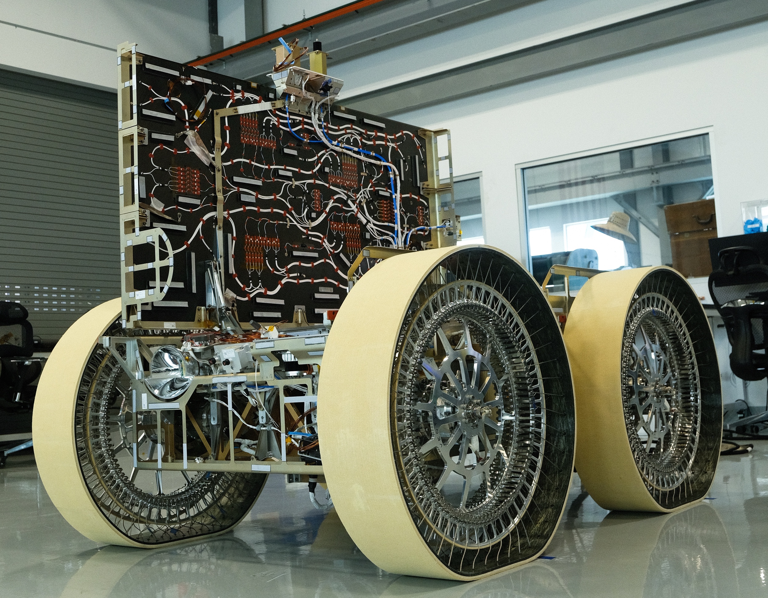

WASHINGTON — Astrolab’s first lunar rover will carry four NASA payloads on a mission planned to launch later this year.
Astrolab announced May 18 that it had reached agreements with four NASA centers to fly payloads on its FLEX Lunar Innovation Platform, or FLIP, rover scheduled to launch on Astrobotic’s Griffin-1 lander late this year.
NASA’s Ames Research Center is providing the Moon Exploration for Titanium with Active Lighting, or METAL, a camera and radiometer designed to identify helium-3 deposits in lunar regolith. METAL is being developed in partnership with Interlune, a company that previously announced plans to fly a helium-3 prospecting payload on FLIP.
The other payloads are a lunar retroreflector array from the Goddard Space Flight Center; the Lunar Dust level sensor and Effects on Surfaces, or LDES, payload from the Johnson Space Center to study dust-induced degradation of key spacecraft systems; and a lidar demonstration payload from the Marshall Space Flight Center.
Jaret Matthews, founder and chief executive of Astrolab, said in an interview that his company reached out to individual centers to see what payloads they had available for FLIP, particularly those “that were ready to go and fit the bill in terms of the science that we think was particularly helpful for future missions.”
The payloads are flying through nonreimbursable Space Act Agreements, with no money changing hands between NASA and Astrolab. That allowed the agreements to be negotiated faster, fitting into the schedule for completing FLIP in time to launch on Griffin-1.
“And it was out of a genuine interest to try to get some really good science out of this mission for NASA and for future moon base elements,” he added.
FLIP is effectively complete now, he said, and will soon begin environmental testing, including shock, vibration and thermal vacuum tests. Astrolab has previously done similar environmental testing on elements of the rover, giving the company confidence in the upcoming tests.
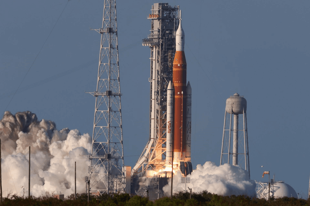
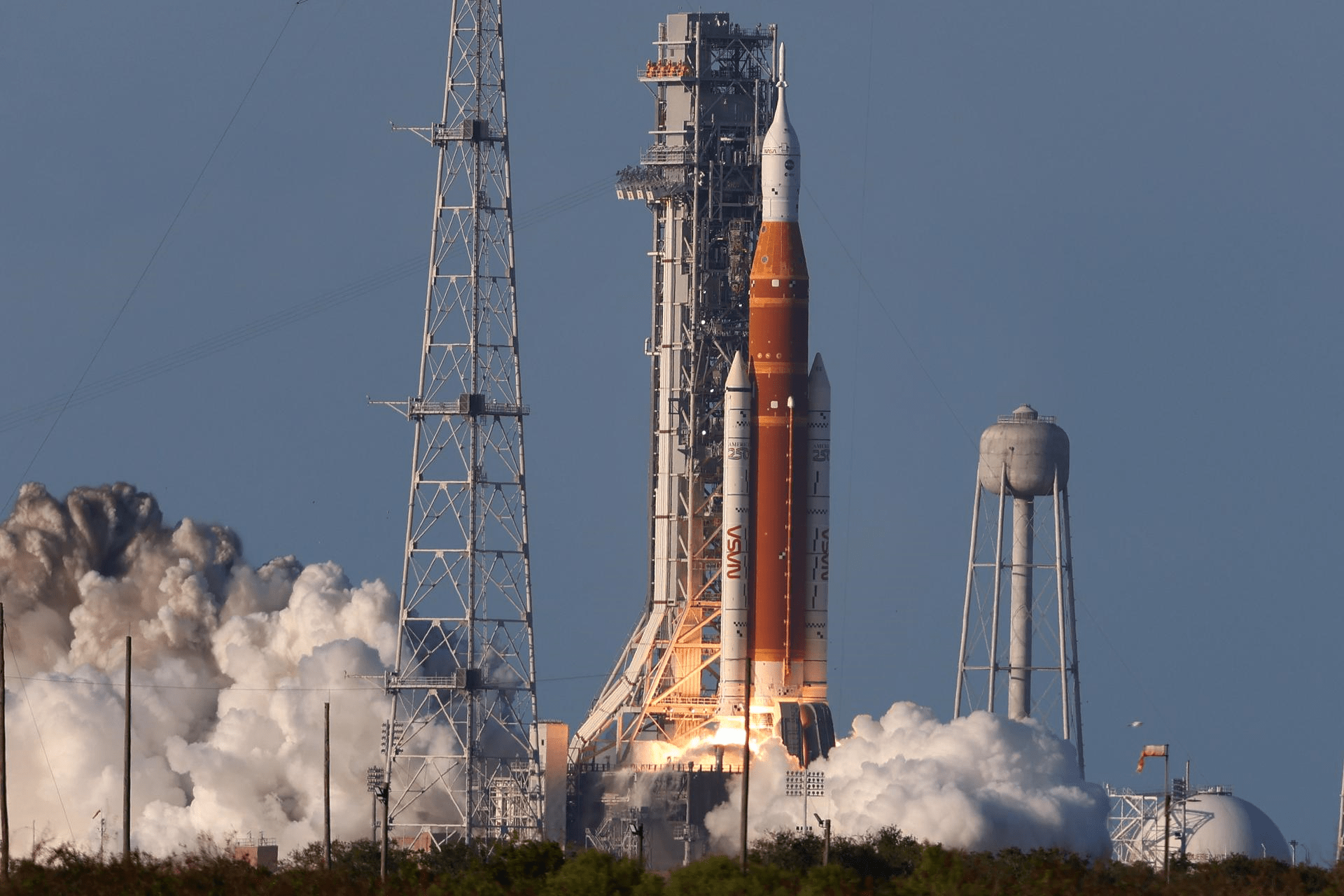
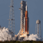
Matthews said Astrolab expects to complete the tests and have FLIP ready by the end of the summer for delivery to the launch site, where it will be integrated onto Griffin-1. That lander is slated to launch late this year on a Falcon Heavy from the Kennedy Space Center.
While Astrolab has been getting FLIP ready for flight, the company has also been busy updating a proposed rover for NASA’s Artemis lunar exploration campaign. Astrolab was one of three companies, alongside Intuitive Machines and Lunar Outpost, selected for NASA’s Lunar Terrain Vehicle, or LTV, program to develop a rover for future Artemis missions.
At NASA’s Ignition event in late March, NASA announced it would not select any of the proposals submitted last year by the three companies, asking them instead to provide revised concepts for a smaller, simpler rover that could be ready as soon as 2028. Those proposals were due to NASA on May 1.
One of the major changes, Matthews said, was that NASA was taking over responsibility for delivering the rovers to the moon, rather than allowing the companies to arrange their own delivery services. NASA put requirements on the mass and dimensions of the rovers so they could be flown on landers through the Commercial Lunar Payload Services contract.
“They defined the mass and volume in which we had to fit, and it was substantially smaller than what we were previously working with,” he said. “So, we did have to overhaul the design in quite short order to fit within the new bounding box.”
The company has not disclosed details about the design it offered to NASA, but Matthews said it retains some of the hallmarks of its earlier concept. “It will be recognizable as an Astrolab product, I would say.”
He said NASA informed the companies that the agency planned to make awards on May 22, a timeline other companies involved in LTV have stated. NASA wants the companies to have their rovers ready 18 months after the award.
“I think we’re well suited to do that because we just did it with FLIP,” he said, adding that many of the technologies for its LTV rover will be tested on FLIP. “That being said, LTV is going to require all of our focus to hit that schedule. It’s a super ambitious schedule.”
It’s similar, he said, to the schedule for the lunar rover used on the final three Apollo lunar landings, but that rover was far less complex than the LTV.
“I’m personally energized by the changes that came out of Ignition,” he said. “We don’t want to let NASA down, so we’re going to put our full focus on LTV and make it happen.”


Related Posts


Stay Informed With the Latest & Most Important News
Previous Post
Next Post


Advertisement
-
 01Two Black Holes Observed Circling Each Other for the First Time
 -
 02From Polymerization-Enabled Folding and Assembly to Chemical Evolution: Key Processes for Emergence of Functional Polymers in the Origin of Life
 -
 03Astronomy 101: From the Sun and Moon to Wormholes and Warp Drive, Key Theories, Discoveries, and Facts about the Universe (The Adams 101 Series)
 -
 04True Anomaly hires former York Space executive as chief operating officer
 -
 05Φsat-2 begins science phase for AI Earth images
 -
 06Hurricane forecasters are losing 3 key satellites ahead of peak storm season − a meteorologist explains why it matters
 -
 07Binary star systems are complex astronomical objects − a new AI approach could pin down their properties quickly